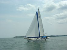
23 June, 2009

Back on the Bay

Location: Deltaville, Virginia
Position: N 37 32.845 W 076 19.778

Wow! It’s been almost a month since we returned to the Chesapeake and we haven’t even hit a lick on the Khronicles! Time to remedy that. We’ve decided we’ll finish up the one we started in the Dismal Swamp Canal and let this one be just a quick “catch up”.

So, let’s see….

We left Hospital Point, sailed up to the Mobjack Bay to the East River where we spent a couple of days visiting our friends at Zimmerman Marine and getting the 1000 hour service done on our engine.

Our next stop was Mike and Helen’s dock on the Coan River where we would leave Rachel while we visited family. We left Zimmerman’s at 9:00 am planning to travel around 30-40 miles and spend the night somewhere near Reedville, VA. That would make the next day to the Coan a short one.

As usual, however, our plans were etched in water. We somehow managed to catch an incoming tide giving us a half knot or better boost. Don’t ask us how – we’re notoriously bad at predicting currents. In fact, we decided we had a favorable current this time because we had NOT predicted it at all, not even thought about it!!

At any rate, we rode it all the way from the Mobjack up to the Coan River – including the Potomac River leg! We made it in to our friends dock just before dark having averaged 6.4 knots over the 67 nautical miles we traveled. That’s pretty good speed for us when we’re not in the Gulf Stream.

While we were tied to the dock, Mark removed Rachel’s anchor windlass (an electric winch that pulls the anchor up for us) and sent it back to the factory for some preventative maintenance. We made arrangements to borrow a car from some friends and set off to visit Julie’s daughter Charlotte and her family in Radofrd, VA.

After a wonderful 10 day visit we returned to Rachel with our grandson Alex in tow. Weather and returning the car to Richmond kept us on the dock for a day during which Alex caught his first fish, a croaker, which we threw back.

We sailed down to Deltaville, dropped the anchor, and spent the rest of the week catching up with friends, playing with Alex, and lounging around the pool at the marina. Alex’s family (including little sister Emma) came to pick him up and we all spent a night on Rachel together. It was hot and crowded, but we had fun and were sorry to see them all go the next day.


Since then we’ve been working on Rachel, getting her ready for our trip to Maine in a few weeks.

It’s time to move on. We feel like we’re growing barnacles - we’ve been anchored in Deltaville for two weeks. We’re really dug in well – a 40+ knot squall blew through here last night and we didn’t budge. When it’s time to haul anchor (probably tomorrow) the newly refurbed windlass will be given a good test. It’ll probably take an hour just to rinse the sticky black Chesapeake Bay mud off the chain!

That’s pretty much it in a nutshell. We’ll see if we can’t do a better job getting the Khronicles out once we start moving again.


24 May, 2009

Elizabeth City and the Great Dismal Swamp

Location: Hospital Point, Portsmouth, Virginia
Position: N 36 50.742 W 076 18.044


With the wind vane steering a good course on a close reach, we have a lovely, silent sail in 10-15 knots across the Albemarle Bay to the Pasquotank River and, finally, Elizabeth City.

On our way up the river we notice a huge building on the western shore. Later we look up and see a blimp hovering near the building.

Julie: “I wonder what that could be?”
Mark: “Maybe it’s a blimp factory.”
Julie: “Ha Ha. Yeah, right.”


Elizabeth City provides 14 free slips and a couple of bulkheads to which visiting boaters can tie up for two nights. If there are more than 4 new arrivals, the “Rose Buddies” put on a free wine and cheese reception! This has been going on for over 25 years – what a nice town!

We pick a slip, tie up, and go for a nice, long walk through the commercial district and the nearby old neighborhoods. Four more boats arrive, so at 4:30 we meander over to the Rose Buddies reception. There, we learn that the big building we went past earlier is, indeed, a blimp factory! All the blimps in America (except the Goodyear blimps) are made here!

We visit with the other boaters who have arrived then head back to the boat. When we get there, a voice message tells us Mark’s brother and sister in law are on their way to see us. We have a nice couple of days visiting with them, checking out the blimp factory, going for a sail, getting stopped by the Coast Guard for our first ever boarding (a random safety check – we passed), and catching up with each other – we haven’t seen each other since Mark’s dad’s funeral last fall.

Saturday morning we get up and walk about 50 few feet to the farmer’s market at the park behind the free slips. We buy four tomatoes, a bag of green beans, some zucchini, and some yellow squash – all for $4.00 – a good deal on some great vegetables. We say our goodbyes and head up the Pasquotank River toward the Great Dismal Swamp Canal.

The Pasquotank River above Elizabeth City meanders and narrows but retains plenty of depth. We pass logs covered with turtles, spot lots of different birds and trees, and watch the swampy bits slide past. Surprisingly there are no bugs. The shore closes in on us and soon we’re negotiating the turns with only 20-30 feet between us and the log and stump strewn banks on either side.

We reach the lock up to the canal a few minutes after it closes so have to wait a couple of hours for the next locking. We drop the anchor on a short rode, sit back, and relax. That’s when we see it – a huge mottled snake thicker than Mark’s arm lying on a stump sticking out of the water only about 20’ from the boat. Another boat arrives and we point it out – the captain says “That’s a cottonmouth.” Wow. Poisonous!!!

The lock opens and we enter and loop our lines around the bollards. The water begins to rise and we’re lifted about 8-10’ up, taking up the slack in our lines as Rachel rises to the level of the canal. The lock opens and we’re presented with a 100’ wide arrow straight strip of water. We pass a small town and tie up for the night at the Dismal Swamp Visitors Center – the only visitor center in North Carolina that services both auto and boat traffic. We have a nice short walk around the immediate grounds, then retire to Rachel for dinner and a quiet night.

In the morning we go for a longer walk on the board walk through the swamp, a winding trail through the woods, and along a dirt road that parallels the canal. It’s beautiful here, but we’re ready to get going again. At about 9:30 we release the lines and have a nice leisurely run up to the next lock.

As we’re locking through, dropping 12’ or so, the lock keeper walks by and spots Mark’s conch horn. He asks Mark to play it for him, then disappears for a second. He reappears with a colorful painted conch and proceeds to give Mark a series of lessons guaranteed to make him a better, more versatile conch player. “Conch Horn Bill” has a well deserved reputation for being one of the best conch horn players around, and Mark appreciates being “schooled”.

A few more hours and we’re anchored at Hospital Point on the Elizabeth River, Mile 0 of the Intracoastal Waterway with only another hour or two to go until we’re on the Chesapeake Bay.

11 May, 2009

Cape Lookout

Location: Cape Lookout, North Carolina
Position: N 34 37.825 W 076 32.401

After heading up the Cape Fear River and spending a lovely day with family in Wrightsville Beach we headed offshore on Mothers Day for a lovely sail up to Cape Lookout. We had heard from friends that it was a wonderful spot to anchor and wind down - they were absolutely correct. Cape Lookout is a National Seashore protected by the National Park Service. As you would imagine, it has pristine beaches and is totally undeveloped except for the old lighthouse and coast guard station and associated buildings.

The cape and its associated shoals are one of the most treacherous stretches of the eastern shore for passing ships. The coast of North Carolina between Cape Lookout and Cape Hatteras is known as “the graveyard of the Atlantic”. Because the land was so low a ship could be aground before realizing it so a lighthouse and a coast guard station were built there in 1812.

Behind the outer cape and its shoals is a large, deep bight of water teaming with loggerhead turtles. We spent our first night at the northern shore against Shackleford Banks, an island that is home to over 100 wild horses. As we dropped the anchor we could see some of them cantering along the beach. The next morning we dinghied ashore and enjoyed a long walk along the beach accompanied by a herd of 10 or so horses. We really needed the exercise after sitting on the boat for so many days!

Later we took Rachel to the south shore and anchored in 25 feet of water. The afternoon was spent in the cockpit reading and watching the loggerhead turtles swimming around us.

The next morning we set off fairly early and had another really long walk along the beach, through the now closed Coast Guard station and along to the lighthouse. The lighthouse is not open to the public but we looked around the lightkeepers house and its associated buildings then walked all the way back along the beach. We felt like our walking muscles were finally starting to get back into working order!

We moved on to Beaufort the next day but we definitely want to come back and spend more time here, Cape Lookout has earned a place on our list of favourite stops.

Mark & Julie
s/v Rachel

07 May, 2009

Landfall

Location: Southport, North Carolina
Position: N 33 55.039 W 078 01.690

With the Family Island Regatta finished we were on the fast track to get back to the US. After a couple of days waiting out high winds and seas we set sail with our new friends on Osprey and Magic. Our first day was a rolly ride up the Exuma chain. In the morning we caught another mahi in the deep water, so another wonderful dinner of grilled mahi-mahi was assured. Around noon we passed through Cave Cay Cut onto the banks side and the seas flattened out for the rest of the day. It was a long day but good sailing. We topped off our fuel and anchored off Sampson Cay for the night.

A fairly short hop the next day to Normans Cay gave us the opportunity for an afternoon ashore. Every chance for a walk and a swim is precious now as we won’t be able to enjoy this azure blue water much longer. Normans Cay has a bit of a nefarious history due to Carlos Lehder’s cocaine smuggling operation based there in the late 1970s and early 80s. (http://en.wikipedia.org/wiki/Carlos_Lehder).

The next day was another long downwind run up to Nassau – we all got out our spinnakers (those really colourful big downwind sails). It was a great sailing day. We anchored about 5 miles from Nassau at Rose Island, a very picturesque spot and had our final snorkel and swim of the season. Looking in one direction we could see the skyline of Nassau with it’s tall buildings and cruise ships, and in the other direction we saw white sand, coral reefs and desert islands reminiscent of Gilligan’s Island. We had a bit of a rolly night in the anchorage and none of us slept that well, probably due to anticipation of the 600 mile trip we were embarking on the next morning.

We like to do 3 hour watches on a passage and Osprey and Magic prefer 2 hour watches. We decided we would stay in contact on a single, nearly unused channel on the VHF radio. Because of our alternating watch schedule we had revolving people to chat with during our trip, making the passage back a bit more interesting than usual.

We weighed anchor 06:00 and the wind was dead behind us. This isn’t a great direction for Rachel since we broke our whisker pole (but that’s another story…) – so we ended up motorsailing more than we’d like. This was to be the case for most of the trip back. Every time we changed course to head further west, then north, then east, the wind changed direction and followed us, remaining dead behind.

At around 04:00 on the second day we were approaching Freeport on Grand Bahama Island, the other major city and port in the Bahamas. No chance of falling asleep on watch here as there were too many ships and lights to watch out for. A bit nerve racking but with all 3 boats watching out and chatting on the VHF we managed to pass by with no problems.

We now started to head NW and into the Gulf Stream – here’s where we’d make tracks, picking up a 3-4 knot boost in speed. It took us longer than we expected to reach the maximum flow, but eventually we were honking along at times making 11.4 knots over the ground (that’s really fast for us we usually do well to make 6.5) Once we hit ‘the Stream’ we headed North and now it was just a matter of riding it as far as we could. Of course the wind changed again, remaining behind us, and we continued to battle to keep the sails inflated in the rolly seas. Rolly is fine if all, you have to do is sit in the cockpit and look pretty but when you are needing to wash, sleep, prepare food, do the dishes, and use the toilet it’s not all that much fun!!

Every day we checked the weather and on the evening of day 2 the report was for the winds to shift to the north and pick up in a couple of days. At that point we decided we’d head for Charleston, about 100 miles short of Beaufort, our preferred landfall. We started to work our way out of the Gulf Stream. The next morning, as we were approaching Charleston, the weather mavens decided that the deterioration of the weather had slowed down so now it looked like we would have another day of decent weather. At the last minute we changed plans and direction and headed another 70 miles up the coast to Southport. For the last few hours in the early morning on day 4 we had to slow down to 4 knots or less so that we would not arrive before dawn. It’s definitely not much fun making landfall in the dark!! So at 06:00, 4 days and 4 nights and 630 miles after leaving the Bahamas, we were negotiating the Southport entrance channel.

Around noon the heavens opened and we had a huge thunderstorm and wind shift. Boy, were we glad we were in a safe harbour. We timed the weather just right!!

It’s hard to believe that just 8 days ago we were in George Town.

28 April, 2009

Family Island Regatta

Location: George Town, Exumas, Bahamas
Position: N 23 30.788 W 075 44.902

The Family Island Regatta has been one of the highlights of the season for us. It is THE event of the year for Bahamian sloop racers. Boats and people arrive from all of the islands during the week. We watched mail boats from all directions piled high with boats. The closer islands tow their boats, sometimes 3 or 5 behind a big power or fishing boat. George Town was humming with excitement. The government dock, usually just a flat concrete area, is suddenly covered with wooden ‘buildings’ selling food and drinks and everyone is milling around, ‘strutting their stuff’.

Tuesday and Wednesday were the junior races then Thursday through Saturday were the serious ‘A’, ‘B’, and combined ‘C’ and ‘D’ class races. Each class is a different size boat but they are all the same basic design. Flat decks with huge sails, there are 2 boards (called ‘prys’) that slide from one side to the other and as the boats heel (tip to the side) with the wind, more and more people clamber onto the boards to balance the boat and stop it from tipping over. The number of crew aboard depends on how much wind is blowing for that day. We were lucky in that the winds all week were going to be 20-25 mph resulting in some very exciting racing.

The start of a Bahamian sloop race is really something to watch. All the boats line up at the start line with anchors set and their sails down. The start gun fires and there is a mad frenzy aboard to haul the anchor, pulling the boat forward to provide a bit of way allowing some control of the helm until the sails are raised, the wind fills them, and then they’re off. This can often seem very chaotic and exciting to the spectators. At one start, three boats got their masts tangled up together causing one to drop out and the other two to finish last.

The course is set up with a windward leg and a downwind leg, usually with 2-3 trips around the buoys. We spent most of the races in our dinghy anchored near the windward mark. We watched the sloops tacking back and forth towards us from the starting line. Every time the boats tacks all the guys out on the board scurry back onto the boat, the pry is shoved out onto the other side and they all clamber back out as quickly as possible while the rest of the crew are bringing the sails over to the other side. What an exciting week we wouldn’t have missed it for anything.

The times from the 3 days of races are all combined to produce the winners. The Staniel Cay boat “Tida Wave”, previously raced by Rollie Gray (we wrote a bout his funeral last year) took the class ‘A’ honors. During the races some boats capsized due to the heavy winds, a few sank (there’s something sad about a lone mast sticking up above the water in the middle of Elizabeth Harbour), and one lost it’s rudder and sank right after crossing the finish line! It was thrilling and we loved being here!

On the last day we decided to watch the class ‘A’ race from shore, close to the starting line. We got there fairly early and picked out a great spot at the end of aptly named Regatta Point. As time went on more and more people arrived. The race was about to start when we realized that a big crowd of Bahamians with beer, mainly men from all the different islands, had gathered just behind us. These were the tacticians!!! As soon as the race started they were all shouting instructions and play by play to the racers (who of course could not hear them), and to each other. As the race progressed more beer was consumed and the voices got louder and louder. It was such a din we couldn’t understand most of what was said. It was impossible not to get caught up in their excitement and frenzy. By the time the first boats crossed the finish, these guys were all shouting, cheering, moaning, and carrying on to beat the band. What a show!

Speaking of beating the band, we also got to see the Royal Bahamas Police Force Band perform immediately following the class ‘A’ finals. These men and women are amazing! Complex rhythms, great song selection, beautiful uniforms, and leopard skins. Various members of the band got to showcase their stuff – the snare drummers tossing sticks back and forth, the bass drummers tossing a bass drum over the heads of other band members, the cymbal guy doing some gymnastic cymbal playing, and the drum major doing some pretty hot movin’ and shakin’. He even picked out a lady from the audience to hootchie-coo with! It was really great. It’s at times like this and the New Years Junkanoo we attended in Green Turtle Cay that we wish we had a video camera. Oh well…

20 April, 2009

Jumentos & Ragged Islands

Location: Water Cay, Jumentos, Bahamas
Position: N 22 18.931 W 075 46.042


Okay. All the excitement at Raccoon Cay aside, we are really enjoying our stay in the Jumento Cays and Ragged Islands.

After spending a few days at Buena Vista Cay (N 22 25.503 W 075 50.182) snorkeling and walking the beaches, we head down to Double Breasted Cay, just south of Raccoon Cay. We take our time, checking out some smaller cays, rocks, beaches, etc. on the way. We arrive, drop the anchor, and gaze (N 22 18.931 W 075 46.042). We soak up the beauty of the water, the islands, the sky. It’s absolutely beautiful. Yeah, yeah, we know – if we use up all the superlatives here, how are we going to be able to describe the other islands in the chain? We’ll just have to reuse them. We’re smitten.

To quote our friend Carl on ‘Diva’, “We are now at perhaps the most beautiful place we have been in the Bahamas, save Conception Island. Simply gorgeous. Like pictures of South Pacific Islands, only Bahamian topography and colors.”

We spend several days walking the beaches and exploring the rocky coastline. We find a spar, stem w/ several hull planks, and a stern on the beach – we’re guessing it's the wreck of a Haitian boat. It's been there a while and is well above the high water line, so it must have gotten pushed up there by some pretty ferocious waves.

The wind goes a bit more southerly so we decide to move on. We travel a couple of miles to Johnson Cay (N 22 20.226 W 075 46.839). The anchorage is a natural harbour with great protection from the south and with the light wind, we’ve got nearly no ocean swell to contend with. Yet another superlative-laden gem! There are a couple of really nice reefs in the anchorage, so we get to snorkel right off the boat.

Now that the heat’s off, we return to Raccoon. There are five other boats already there, so we decide to head up to the northeast corner of House Bay (N 22 21.721 W 075 48.886) to avoid the “crowd”. See how spoiled we’re getting? We shared the anchorage at Black Point with 73 other boats earlier this year and now we’re calling five boats a crowd. Due to the ‘large’ number of boaters here we decided to have a happy hour and bonfire on the beach. Again hikes, beachcombing and snorkeling were on the agenda for the next couple of days.

With heavy hearts we needed to make tracks north we had only 3 days to get to George Town for the Family Island Regatta. We made the trip in 2 really long days stopping overnight at Water Cay and making George Town just after dark on the second day

15 April, 2009

Who you gonna call?


Location: Raccoon Cay, Ragged Islands, Bahamas
Position: N 22 21.393 W075 48.814

The chart book says “The Ragged Islands are not just more southerly Exumas but rather unpopulated wilderness with only one tiny settlement that’s closer to Cuba than to George Town. Cruisers must be totally self-sufficient here; there are no services to speak of in the entire chain. “

No chandleries, marinas, fuel, spare parts, groceries, toilet paper, restaurants or beer. And only a little water. Being this remote means we’re pretty much on our own if anything happens to us or Rachel. If we run aground, it’s up to us to get off. If we break down, it’s up to us to get going again. If we get sick or are injured, we’ll have to be our own doctors. Duncan Town, the lone settlement on Ragged Island has a population of less than 100. It’s very remote and definitely off the beaten path. This, of course, is what lures Rachel and her crew down for a visit. Not to mention that it's also absolutely gorgeous here with great fishing, snorkeling, hiking, and beachcombing.

It took us 3 days (of awesome sailing we might add – woohoo!!) to get here. Our friends on Diva have already been here for 2 weeks and we arrange to meet them in the anchorage at House Bay on Raccoon Cay. After their enthusiastic description of the island chain we are really looking forward to the peace and quiet.

As we pull in to anchor we notice a blue boat in a small bay just north of us, which we think seems a bit unusual as it is so remote. We assume it’s a fisherman from Duncan Town on Ragged Island, a few islands to the south. As we approach, however, we are able to read "POLICE" on the side. We can also tell it’s not one, but two, high tech high speed blacked out stealth Bahamian Defence Force patrol boats rafted together with a third white-hulled boat alongside. After we get anchored our friends on Diva say they’ve been zooming around the area all day. They have no idea what’s going on but are very pleased to see us and our travelling companions on “Osprey”. Safety in numbers, and all that.

After a while a helicopter arrives and starts circling in an obvious search pattern over the island. We discover they’re coordinating with the police boats (“Ghost Rider I and Ghost Rider II”) on VHF channel 21, so we listen in. The helicopter has to leave to refuel in George Town. Another arrives - bright orange and white, we see it’s a US Coast Guard chopper. The chatter on channel 21 doesn’t tell us much – search here, fly over that island there, look there’s a house with a rusted roof.

We still don’t know what’s going on, but we’re nervous about going ashore. One of the boats has children aboard, so the father calls the Bahamian Defence Force guys on the VHF and asks if it’s safe for us or if we’ll interfere with their operations if we go ashore. They reply “No, you should be fine. We’re just looking for some suspects.” That makes us all feel so very much better…..

Raccoon Cay is only about 50 miles north of Cuba and maybe 80 miles from Haiti so there is apparently a lot of drug running and illegal immigration activity in the area. Apparently it's a fairly frequent occurrence to see the US Drug Enforcement Agency in the area trying to catch drug runners!!! And we thought it would be quiet and serene here!! Something big must be going on because they're throwing a lot of effort and resources into it.

We all decide to go to sleep, hoping they’ll be gone when we wake up. In the morning one of our friends tells us she woke up in the night and, seeing a rock she hadn’t noticed earlier, wondered if they’d dragged anchor. Naked, she grabs the binoculars, climbs up into the cockpit and takes a closer look at the “rock”. It’s the stealth boats, blacked out, no lights showing and engines barely making any noise. Only a hundred feet or so away. Then she thinks “I wonder if they have infra red binoculars? Oops!” It doesn’t take her very long to vanish back down below.

Gone in the morning? Nope. In fact, not only do we have the Defence Forces stealth boats and the Coast Guard helicopter, we also have two other choppers circling the island.

Now we hear the Coast Guard chopper talking to “Delta One” who have apparently been dropped on the ground for a recon mission. Wow, it just keeps getting better.

One of the choppers: "We heard shots were fired." Delta One: "If they were, they weren't firing at us." Other chopper: “There are 3 sailboats on the west side of the island (meaning us!!) – you should probably check them out!” Defence Force boat: “We already have” (even though they haven’t – oh, wait – our binocular wielding naked friend – maybe they figure they checked that boat out well enough to count for all three of us).

It’s about this time we decide to move. No point staying here since we can’t go ashore and don’t even feel safe dinghying around. All this cops and robbers stuff makes us all feel downright nervous, not to mention detracting a bit from the allure of the Jumentos.

We’re grateful that the Bahamian Defence Forces and the US Coast Guard are on the ball, protecting the Bahamian people and their guests from “the bad guys”. That being said, we’re also grateful that we have the ability to leave them all behind, at least for a while. We haul anchor and sail a few miles north to Buena Vista Cay. We anchor off a beautiful mile long beach lined with palm trees, in bright blue water with easily accessible coral heads for snorkeling, and not a cloud or helicopter in the sky. Aaahhhh.

When we made the decision to visit the Jumentos and Ragged Islands, we knew from the start that we’d have to be totally self-reliant. There’s a certain sense of vulnerability that accompanies this, and we’re prepared to deal with that. It’s completely unexpected, however, to feel this entirely different form of vulnerability imposed upon us from outside by the “civilization” we supposedly left behind.

"Who you gonna call?"

31 March, 2009

Immaculate Conception

Location: Conception Island, Bahamas
Position: N 23 50.685 W 075 07.316

“Just when you thought it couldn’t get any prettier….”

We’re standing on a bluff looking out over the Atlantic Ocean with our friends Bob and Francie from Barefootin’. It’s mid afternoon and the sun is still fairly high in the west. The sky is a crystal clear blue and is dotted with puffy white clouds. Long tailed brilliantly white tropic birds soar above us on the light easterly breeze. This is the first visit to Conception Island for all of us and we are in awe at the beauty that surrounds us.

Our day started this morning with the 6:30 weather forecast. It’s only about 20 miles from Calabash Bay on Long Island (where we anchored last night) to Conception Island, but Conception has no all-weather anchorages. Several days of settled weather is pretty much a requisite. We were unable to make the trip last year as the weather was not favorable for a visit, but today’s forecast sounded good, so we hauled anchor at 8:00 am.

Winds were light, but just forward of the beam, and Rachel moved along nicely on her favorite point of sail. We dropped the fishing line over and relaxed into the lovely rhythm of an easy sail on mild seas.

About 3 miles out of Conception we caught a nice 32” mahi-mahi. Yippee!! Fresh fish tonight! We furled the head sail to slow down, and by the time we landed the fish, filleted it, and cleaned up our mess, it was time to start the engine, drop the main, and pick our way through the coral heads to our anchorage.

Yet another exquisite white sand beach greeted us. The water is as clear or, if possible, even clearer than any we’ve seen so far in the Bahamas. We anchored in 16’ and can still see the bottom in great detail. It’s almost like we’re floating in air.

After we got all settled in we dinghied in and met the Barefootin’s on the beach for one of our favorite activities – a walking exploration of a new island.

Conception Island is a National Trust island. There has been no development here, and fishing, shelling, picking the flowers, etc., are all prohibited. “Take only pictures and leave only footprints.” This island is truly the crown jewel in the Bahamian national park system.

We watch and listen to the birds, smell the ocean air, feel the breeze on our skin, and are grateful for the opportunity to share this incredibly beautiful place with each other. We walk back down the trail, across the beach, get in our dinghies, and return to our boats. Rachel’s crew still has work to do – we’ve invited friends over for fresh grilled mahi-mahi tonight.

After dinner there’s a lull in the conversation as we watch the sun slowly sink into the sea in the west. After a minute or two, Bob says “If this ain’t God’s country, then it must be about 20 yards over that way”.

24 March, 2009

Mr. Knowles

Location: Long Island, Bahamas
Position: N 23 21.521 W 075 08.506


Our trip to the bank and museum were delayed for various reasons, none of which was very important – it’s just difficult to get much done sometimes with our hectic social schedule.

Yesterday we finally hitch hiked down to the bank and the museum in Buckley, about 10 miles south of Salt Pond with our friends Carl and Debbie from Diva.

We paid our $3 non-resident entrance fees and toured the local museum. It’s wonderful, and well worth the price. One of the displays featured various seeds from some of the agricultural products that provided island residents with their livelihoods some time ago. Mark noticed a display of “sapodilla seeds” and asked the museum lady to tell him about sapodillas – what they look like, how they were used, etc. She is an interesting and friendly woman whose husband is the principal at the nearby school.

“Oh,” she says, “I’ve got one right here in my lunch. I’ll show you.” This she proceeded to do. She then divided it up into four parts and gave us each one to try.
We told her we couldn’t bring ourselves to eat part of her lunch to which she said “Oh, it’s okay – I’ve got a whole tree full of them at home and, if I really want one for lunch, I’ll just go pick one from Mr. Knowles’ tree right next door.”


So we let her talk us into eating it – skin and all, the only part not eaten is the seeds. We all agreed that it was delicious – sweet and a bit musky.

We spent an hour or so at the museum, then left to start our trip back to the boats. As we passed the sapodilla tree next door, this little old man walked out toward us and said “I ain’t got no ripe bananas out here, but I got some out back.” We explained that we were looking at his sapodilla tree. He said “Come on over to this here dilly tree! I’ll get you some ripe dillys to eat.”

He then proceeded to climb up into the tree and shake the branches, causing ripe fruit to fall to the ground at our feet. We were afraid he was so fragile that he might come tumbling down with all the fruit. “You just pick them up and come with me.” he said as he climbed back down to the ground.

He herded us all up and took us back into his garden - rows and rows of banana trees, papayas, corn, melons, etc. All of which were growing in little dirt areas that he had been scrabbled out of the rock. It was amazing, and obvious that he'd spent a long time doing a lot of hard work.


He told Debbie, who is petite, that she looked about nine years old. Later, just as we were leaving, he said she looked like she was fourteen. I said "Then she aged pretty quickly, since you just said she was nine" to which he said "Well, time flies when you're having fun."

We learned a bit more Bahamian along the way. He told us that “dem some” means “they’re no relation or friend of mine”. It’s used like “Them boys with knives in Nassau who robs people – (shake head “no”, slowly) dem some.” We also learned about “trans”, as in “I need to get me some trans to get the bananas out to the road so I can sell them.” Trans meaning transportation, of course.

Gentlemen like Mr. Robert Knowles, ladies like the museum lady (maddeningly, none of us can remember her name), and all the other friendly, gracious, and kind people we’ve met on these out islands of the Bahamas set wonderful examples for all of us and remind us to keep it simple and honest.

Humbled once again.

19 March, 2009

Little San Salvador and Long Island

Location: Long Island, Bahamas
Position: N 23 21.521 W 075 08.506


We arrived at Little San Salvador Island (N 24 34.633 W 075 57.282) on the 16th after a wonderful sail from Fernandez Bay, Cat Island. We passed through a “fishing hot spot” as noted in the chart plotter, but unfortunately never even got a nibble.

When we arrived we found a huge cruise ship anchored just off the island, but just as we arrived, she raised anchor and we had this lovely beach to ourselves.

The Holland-America Line purchased Little San Salvador and has turned it into a somewhat Disney-like “island paradise” for their passengers. It seems the ships move from one destination to another at night so the passengers can sleep and not get bored with the travel, then anchor at various “island paradises” for the day so they can enjoy all the amenities.


Things like beaches with big nets around them to keep out the sharks; swimming with the sting rays, also in a big fenced in area – the sting rays have been rendered harmless by removal of their barbs; jet skiing; visiting a not-very-authentic Bahamian church (we knew what it was because of the big “Bahamian Church” sign on the front); relaxing on one of the thousands of recliners that line the beach; horseback riding; or sitting in an open cabana with an air conditioner blowing on you.


One gal we spoke with who works there told us that 3,000 – 4,000 passengers will debark for the day from a single cruise ship – and sometimes there are two cruise ships in port concurrently.

No cruise ships were due in until Friday, so we had a couple of days to explore, walk the trails, and swim in the crystal clear water.

On the 18th we weighed anchor at 2:00 am and had a long 90 mile sail down to Thompson Bay, Long Island. We were really surprised to find over 40 boats here ahead of us. When we were here about this time last year, there were only a dozen or so.


We’re looking forward to hitch hiking to the bank and museum tomorrow.

Fair winds.