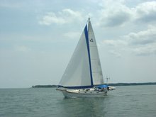
Location: Lake Mohave, Nevada
We've had a wonderful 3 week visit with one of our sons (and some great friends) near Redding, California. Apparently, we've been having so much fun (and are soo slack) that we've forgotten to take any pictures!! And now it's too late as it's time for us to say goodbye and start wending our way back to Virginia.
We've had several discussions about which route to take but, after several false starts, it all comes down to what the weather is doing when it was time to leave. Shades of sailing on Rachel, eh?
One of the few things we do know is that we want to stay, as much as possible, on "the green dots". They mark "scenic routes" as defined by our maps. Once we pick the general direction we want to head, we then look for the green dots in various resources and try to spend most of our time following them, as long as we're not getting too far off our track ("too far" being about as undefined and flexible as possible).
April is not the best time to be traveling across the US as there is still snow in the north and high winds, rain, and tornadoes in the middle and south. The upside, however, is that the prevailing winds are from west to east, so we're hoping to get a bit of a tailwind for at least part of the way.
We are a bit late leaving as we we've been waiting for some parts for a last minute repair. Three days before our departure we start poring over the big picture weather charts. The northern route is definitely out! Too much snow and too cold – we're sick of being cold after this last winter in the southwest.
What about Interstate through Colorado, that would be beautiful? Nope, elevation is too high for too far and still too much snow!
Sheesh. Well, how about dropping down through Arizona/New Mexico/and the Texas panhandle? That looks pretty clear, and we don't want to go the southern route as we came out that way – we want to see new stuff!
Now which way should we start out? The best forecast is down the west side of the Sierra Nevada mountains, but we've already made that trip so many times and it's NOT all that scenic. Julie really wanted to take California Rte 395 when we came up to Dan's but it was too snowy back in March. Let's check it out now. Ooh! The roads are clear and no snow is forecast! Great – things are coming together. Ok, looks like we finally have a plan!
Oh, wait. We'll still have to go over Donner Pass east of Sacramento which is 7,000 ft above sea level and there's still 10ft of snow up there!! But the interstate is clear and if it's a clear day we should be fine – we definitely won't be spending the night up there <brrr>.
There is rain forecast for the next 2 days with potential snow up at Donner. So we leave just before the rain and find a campground at only 2,000 ft elevation to stage for getting over the pass and down Rte 395 in 1 day – between this rain and before the next cold front.
Bear River Campground is perfect. Unfortunately, (of course!!) the weather forecast changes for the day we're going to traverse the pass and they're now predicting a slight chance of snow and slush up there. Even so, it's still the best travel day. So we wake up early, check the dept of transportation website...no snow...great - off we go!
We turn off the interstate at Lake Tahoe and follow Rte 395 south for 250 miles following the eastern side of the Sierra Nevada mountains. It is absolutely spectacular – it's slightly overcast, but with the snow-capped mountains, beautiful vistas, and a long gradual downhill run with a tailwind we can't ask for a better trip! We stop for the night at a BLM campground at 3,000 feet elevation and have a nice quiet, cool night – great sleeping weather and we don't get the plague!!
The next day we head down to Death Valley. Another long downhill run (with a few pretty steep uphill bits), also outstanding. We're below sea level, wearing shorts and tee shirts, and are loving it!
Day 3's highlight is a visit to the Hoover Dam, built in the 1930s on the Colorado River. Very impressive, and very art deco-ey.
Now
we're in Lower Cottonwood Campground, a small National Park Service
campground on Lake Mohave. We've been sitting here for two days and
will be here for one more while high winds blow themselves out.
We're as snug as a bug in a rug, tucked in behind a few trees and in
between small, steep hills on three sides with the RV facing
northwest into the wind – just like the old days on Rachel! We're
getting some puffs and gusts, but nothing like we find on our walks
outside the protection of our camp site where we have to lean into
the wind to make progress. We definitely don't want to be out there
driving the RV in 25-35 mph sustained gusting to 50 mph winds!
We
know we won't have such stupendous scenery for much longer, and
probably won't have such great luck with the weather for the
remaining 2,100 miles back to Virginia. But as we sit here cuddled
up together sharing a glass of wine, looking over the maps, and
planning the next stage of our trip, we are thankful for such a great
"greet dots" start.


