01 May, 2010

Blame It On “The Rio”

Location: Hotel Catamaran Marina, Rio Dulce, Guatemala
Position: N 15 40.366 W 088 59.538

We last left you at Bahia de Graciosa as we were waiting to cross the shallow bar into Livingston, Guatemala to check in to the country on the morning of Thursday, April 27th.

We got an early start, raising anchor at 5 am to travel the 11 miles to the sea buoy off Livingston. We needed to be there no later than 7 am to catch the highest part of the tide before it started to fall. We made it in time and had no problems going in - we saw nothing less than 6.8 feet, exactly as planned.

After we had crossed the bar we saw a boat with a 7.3ft draft being prepared to leave Livingston. They obviously could not cross the bar as we had done so a smaller vessel had their main halyard and was pulling them over sideways, so their keel would kick over making their draft less. The sailboat was motoring at about a 15 degree heel. Wow, what a sight! They managed to navigate over the bar with no problem.


On the advice of friends, we decided to use an agent named Raul to facilitate clearing in. We anchored off the town of Livingston and waited for 8:00 when Raul's office opened. He arrived at our boat at about 8:30 with 6 officials: customs, immigration, sanitation (a doctor – in scrubs!), a military official, and the port captain all in their appropriate uniforms. That's a lot of people in Rachel's cockpit! If we had not used Raul we would have had to go to each of these people's offices and wait to see each of them, the whole process taking much longer.
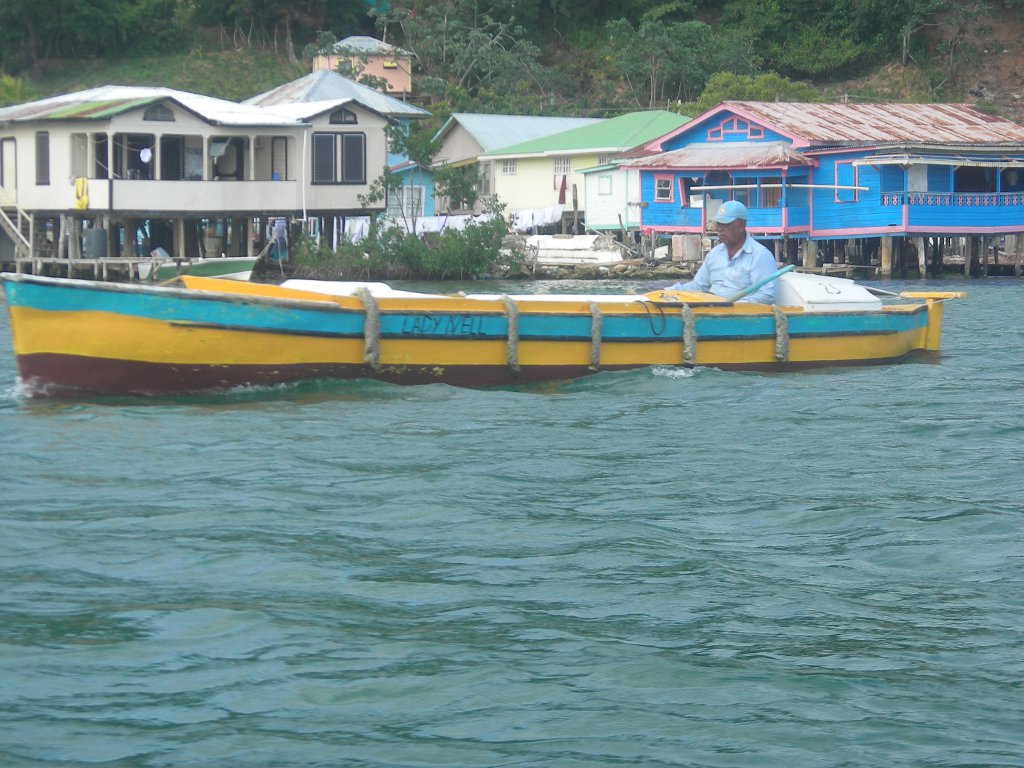
Livingston


We're not really sure why they all needed to come because only the Customs and Immigration people filled out any paperwork and spoke to us. But when in Rome.... So they all sat there for a while and chatted, then they all went back ashore. We were instructed to wait an hour, then go in to the bank to exchange dollars for Quetzals (a US dollar is currently worth about 8 Quetzals) and to go to Raul's office to pay and pick up our visas and boat papers. Wow! That was easy!!

We had heard that Livingston is not a very safe place to anchor out for the night, so we were looking forward to leaving as soon as possible and begin making our way up the river. By 11am we were back on Rachel with our paperwork, after a lovely wander around the town. Soon we were headed up 'the Gorge'. During it's last 7 miles before exiting the coast, the Rio Dulce flows through an absolutely stunning gorge. Some early Johnny Weismueller Tarzan movies were filmed here - you know – the ones where he flings himself off a cliff hanging onto a vine or into the water – we saw his cliff!

Travelling up the gorge


The scenery was spectacular and to make the trip even better there were lots of local Guatemalans fishing from wooden dugout canoes, locally called “cayucos”. Some were casting nets, some setting traps with floats . This is obviously a major source of income and / or food in this area. It was like stepping back in time. We slowly meandered up the winding river wanting to make sure we took in all the sights. After a while we started seeing Mayan style “palapa” houses with a 'garage' of dugout canoes at the waters edge.


What a great trip. Kids, maybe 8 years old, wearing their school uniforms, paddling themselves to school in little dugout canoes. The paddles are cut from boards with a long hourglass shape to form the handle and the blade.

We could have spent all day traveling back and forth up and down this stretch of the river but we needed to get safely anchored before dark. At the top of the gorge the river opened out into La Golfete, a beautiful lake about 10 miles long and 4 miles wide. We were almost at our destination of Texan Bay just inside the lake. A small marina has been built here, by Texans no less. It is only accessible by water and is up a picturesque meandering creek. We anchored for the night off the marina and dinghied in to eat and check out the cold Guatemalan beer. We have not been in a freshwater anchorage with rushes and forest for such a long time we really enjoyed the evening and early morning – especially the sounds of birds, frogs and other wildlife not yet identified.

Rachel at anchor in Texan Bay, we really need those shade awnings down here.

Next morning we made the 15 mile trip through the lake and further up the river to Fronteras, the center of “The Rio” where all the cruisers come to escape hurricane season. We have promised ourselves that we will make a trip back to La Golfete and Texan Bay after we get our boat jobs done. We want to row our wee “Belle” up the little tributaries and see what we find.

At any rate, we are now tied to a dock. We were actually a bit surprised that we remembered how to dock Rachel. We moved into our slip yesterday after being anchored off the marina for three days waiting for other boats to leave, move, and otherwise make room for us. Rachel will be here for the next seven months while we knock several jobs off our “todo” list, do some inland travel, and make a visit back to the US.

Getting our boat jobs done might be a tough row to hoe, however. The resort has a pool, restaurant, bar and lounge with the biggest TVs in the area (not THAT big), lots of little cabins, tennis court, unlimited water and hot showers (aaahhhh!!), and free scheduled launch service into town. Marina guests also get happy hour prices at both bars all day long (cheap and very dangerous!), a 10% discount on meals, and a 20% discount on cabins for guests. All this for $168 / mo. Oh, there's also a book exchange in the main lounge, so it doesn't look like we'll run out of reading material any time soon. It's a tough job, but somebody's got to do it!

Obviously, it's taken us a good bit of time just to catch you all up with our current position. Now all we have to do is is catch you up on what we've been doing since we got here. Time moves slowly here. All we can say is ...

Blame it on the Rio ...

26 April, 2010

Contrasts

Location: Bahia La Graciosa, Guatemala
Position: N15 51.400 W 088 33.406


We leave the island of Utila and begin to head further west. Our ultimate near-term goal is to is to arrive at Livingston, Guatemala by April 27th.

This date is significant to us because the high tide there at 7:00 am is 1.84' higher than mean low water. Rachel draws 6' and the entrance to the Rio Dulce is blocked by a wide sand bar that's 5' deep at mean low water. By waiting until the 27th, we should see 0.84' under our keel as we approach Livingston to clear in to Guatemala.

The fact that the high tide occurs during the morning is an added plus for us. Livingston has a terrible reputation for theft and boardings – everyone's advice is to clear in and get the heck out, heading up river to spend the night at one of the “safe” anchorages further up stream. Needless to say, this got our attention and we decide that the 27th fits our plans to a “T”.


Rachel in Puerto Escondido
We've planned our trip west in a series of day trips so we won't be doing any overnight sails. Not for any particular reason other than we feel like it. We need to clear out of Honduras on April 22nd because our 90 day visas expire on the 23rd. This will leave us in limbo for several days between clearing out of Honduras and clearing in to Guatemala after we cross the bar at Livingston, but everyone we've talked to about it tells us a week or more is fine – no one will mind – so we decide to not let it bother us, either.
Our first scheduled stop along the coast of Honduras is Puerto Escondido. We sail across the Bay of Honduras to Punta Sal and head south along the mountainous and rocky shore. As we approach, the anchorage opens to us and we see a beautiful beach surrounded by mountains and jungle. There are no other boats here, so we pick our spot, drop the anchor, and relax (position N 15 54.544 W 087 37.908 W). This little harbor lies within the bounds of the “Parque Nacional Jeanette Kawas”, a 782 sq. km. National park - and it's a total gem.
We see a couple of locals walking the beach with a dog. The dog runs into the woods and we hear what sounds a bit like a bunch of other dogs barking at it. We finally realize that the “barking” we're hearing is the resident howler monkeys hollering at the dog! We eat dinner in the cockpit listening to the varied sounds of the jungle and the howler monkeys. It's amazing and a little spooky. And we love it.


In the morning we enjoy another show from the howlers. They seem to be more vocal in the morning and at sunset. The whole troop participates in this morning's serenade.
Today is our 3rd year anniversary living aboard Rachel and cruising. We couldn't ask for a more perfect location for this milestone occasion.

The cruising guide says that there are trails in the park so we get ready to head in to shore for a hike. Julie looks over and sees a group of people on the beach. “Hurry” she says to Mark “we can ask that group about the trails”.
On our arrival at the beach we discover it's a group of Americans! They are in Honduras with a church group from Mystic, CT. The church built a school a few miles inland 20 years ago and each year a group comes down to add a new building or do upgrades and repairs. Today is their last day and they traveled here with a couple of guides for a day off before returning to the US.

We ask if we can tag along as the guides speak English and they say sure. We walk through the jungle trail and the guides point out the howler monkeys way up in the trees, gorgeous flowers in bloom, and a few different types of edible wild fruit. We walk with the group over to the next bay where they all get back in their boats and leave us to wander the trails and the miles of empty beaches alone again in this magical place. There are supposed to be jaguars here too but we are hoping we don't bump into one.

It's hard to tear ourselves away, but on Saturday morning we haul anchor and head for our next stop – Omoa. The anchorage at Omoa is protected from the south and east, but is exposed from every other direction. The wind is supposed to be light and from the SE, so we feel pretty good about being here.
That is until the “music” starts. Bump ba dump. Bump ba dump. Bump ba dump. Poor Rachel is shivering her timbers. We're being thrown about the cabin. Bump ba dump. Bump ba dump. Our brains turn to jelly. How can anyone possibly enjoy this? If Rachel were a wooden boat, the caulking would be vibrating out of its seams. Bump ba dump. We turn on the fans hoping for some acoustic masking. We turn on our own music hoping to drown it out. But the insistent bass continues to rumble through all our attempts to mitigate it. We scream and howl, we weep like children and beg for mercy, we cover our heads with our pillows. We drink. Exhausted, and a bit tipsy, we finally pass out and dream strange, rhythmic dreams.

The thumping finally stops at about 4:00 am. Hallelujah! Quality sleep! Until 7:30 – Bump ba dump. Bump ba dump. For crying out loud! It's Sunday morning and they've started it again! Aiiieee!! We'd hoped to spend the day here and check out the town and the nearby castle, but this is too much. We haul anchor and get the heck out of there a day ahead of schedule.

We arrive at Cabo Tres Puntas, Guatemala in late afternoon (position N 15 55.686 W 088 36.028). The anchorage is nice and calm, protected as it is from the 15 knot easterly trades we're seeing. We have a day to kill, so we plan to spend tomorrow relaxing and getting ourselves and Rachel ready to cross the bar to Livingston. It's calm, there's a light breeze and we sleep soundly, hearing only the sounds we're used to – each other breathing and Rachel's little creaks and gurgles.

We wake up in the morning and notice that we're bouncing a bit more than we think we should be. The wind, predicted to be light from the SE to E for the next several days has shifted to the West and is building. By 7:30 am it's blowing 20-25 knots and we're taking water over the bow!

We decide to haul anchor and head for Bahia De La Graciosa, a 5 mile trip south. Julie goes up on the bow to operate the windlass while Mark mans the helm, keeping Rachel's bow into the waves. Suddenly the chain piles up in the chain locker and the windlass jams. So here we are, bouncing around on a short rode, yanking at the anchor (which holds wonderfully), and wondering how long the windlass can take this abuse before it breaks loose. We trade places and after about 10 minutes of effort (and generous application of the “appropriate language toolbox”) Mark manages to free the chain and we finally get the anchor up and are under way.

The best part about our new destination is that getting there puts the wind and waves slightly aft of beam (that means coming at us from the side and slightly behind us) making the ride a lot more comfortable than is was when we were banging right into them. We feel our way through the entrance, tuck up behind Punta Manglar, and drop the anchor.

The difference is amazing. We still have the same wind we had at Cabo Tres Puntas, but there are no waves. It's like being in a lake! The breeze cools the boat above and below. And there are no bugs! We really like this place and wonder why more cruisers don't stop here.

What contrasts we've experienced over the past several days! Going from Puerto Escondido and it's howler monkeys to Omoa and it's howling basses. From being bounced around like a cork at Cabo Tres Puntas to this peaceful, quiet anchorage. We decide to spend the remainder of the day relaxing, reading, and generally winding down from all the excitement, looking forward to a new experience tomorrow when we enter the Rio Dulce.


PS - Real time update – 27 May, 2010

In case any of you heard about the volcano erupting in Guatemala City, don't worry it's 150 miles from us. Poor Rachel does have some black volcanic ash on her decks. And her canvas. And her awnings. And her dinghy. So we are obviously not quite far enough away. http://news.bbc.co.uk/2/hi/world/latin_america/10186112.stm.

Oh, and that potential tropical storm in the eastern Pacific? The one that may track right over us? Not to worry.
http://www.wunderground.com/blog/Weather456/show.html

Then there's the weevil infestation that Julie just found in our beans and flour.

And the ants sneaking in via our docklines – ants, schmantz.

We're doing just fine. Thank goodness Weather Underground downgraded Monday's predicted heat index of 150 degrees F to a mere 120 degrees F or we might have had a problem!

15 April, 2010

Overcoming Obstacles

Location: Jonesville, Roatan, Honduras
Position: N16 23.240 W086 22.568

All over the world people overcome obstacles, annoyances and inconveniences in their lives on a daily basis.

Here in the Bay Islands each island is largely surrounded by barrier reef. These calm the ocean waves before they hit land and therefore provide a safer place to build communities. The islands are covered in high hills covered with rain forest so transportation from one community to the next, before roads were built, was by water. The problem was that to travel from one bay to the next you had to go outside the reef into the ocean and sometimes big seas.

Calabash CanalCalabash Bight Canal


The canal at Jonesville


Oak Ridge Canal. These names are not sounding very Central American are they? Remember the British owned this part of the world for a while.

Solution!! Cut through the coral and mangroves inside the reefs to make canals from one community to the next.

Result – delightful passages through mangrove swamps which create a canopy overhead to provide some shade. On the south side of Roatan you can travel between several bays and about 10 miles without even going out into the ocean. On Guanaja you can travel through the middle of the island from the town of Bonacca to the less populated western side.

Then there are the dories.


In Honduras, a dory is a double ended boat usually ranging from about 15-25' in length with a very narrow beam. Based on dug out canoes, the newer ones are made from wooden planks or fiberglass.

old dugout canoes ("cayucos") still in use in the Bay Islands

They have an external rudder which is steered using two pieces of line. The driver sits in the aft end of the boat and pulls one string or the other, depending on which way he wants to turn. Most are powered by a single cylinder gasoline engine, though some have modern high-power diesel engines. The gasoline ones don't seem to have a transmission. If the engine is on, the propeller is turning. Imagine starting your car and it immediately takes off in gear. You have no brakes, so you have to anticipate way ahead of time and turn off the engine to coast to a stop at exactly the right place. This of course takes lots of practice. It is also necessary to not pull in front of one of them when they are clipping along because they cannot stop - they will just run into you! The good part is that, since the un-muffled engines in most of the older dories make a putt putt putt sound, so you can always hear them coming.

The Lady Nell

All of the communities here are on the water and most people do not have land based transportation . Most of them either have some kind of boat, or they ride on water taxis. In the morning you'll see a dory full of kids in their school uniforms being dropped off at school. You'll see older ladies with their umbrellas, for shade, going to church or the store. All the stores have dinghy docks and some communities don't even have roads - they are completely water access only. We have really enjoyed exploring the canals and wandering though the communities by both dinghy and foot. Everyone is so friendly and will wave and shout hello.

Mark relaxing in Bonocca on an old cayuco converted to a swing

PS – it's really May 18th and we wanted to let you all know we're safe and sound in Guatemala, tied to a dock on the Rio Dulce for the next several months. We'll get caught back up with the Khronicles over the next few weeks.

31 March, 2010

Vacation Take 2


Location: West End, Roatan, Honduras
Position: 16 17.570 N 086 35.841 W

Wow!!  Two vacations in one month - this is awesome! Our son, Dan, from Redding, California was just here for a visit and we got to play again for a whole week. We could get used to this! We snorkeled, ate out, rented scooters, toured the island, visited a lovely botanical garden, sailed, fished, and every sunset we looked for the elusive green flash to no avail.


Even though we didn't have any luck in the fishing department we all had a great time together. Dan got a taste of our cruising lifestyle and enjoyed meeting and hanging out with some of our cruising friends. As an added bonus, he brought a waterproof camera (we have to get one of those) and likes taking pictures - so for a change we actually have some photos to post! As you know pictures tell a thousand words so check these out and see how much fun we had.


Lunch on the beach with friends


Mark & Dan on the rental scooters overlooking the reefs


Barracuda


Dan chillin' on the beach


underwater photos thanks to Dan


Carambola Botanical Gardens


Dan playing with the Monkeys at Gumbalimba Park


Queen Angelfish


Julie & Dan snorkeling


Another sunset with no green flash

Julie & Dan swinging in Gumbalimba park


Thanks for coming Dan - we had a blast!

12 March, 2010

On Vacation


Location: West End, Roatan, Honduras
Position: 16 17.570 N 086 35.841 W

Our friends, Shep & Deb, from Blacksburg were coming for a one day stop on a cruise ship so we thought West End would be a good place to entertain them.
Here's a view of the beach and a resort from Rachel at anchor.

West End (surprisingly located at the west end of Roatan) is a small town that has one street which is just a dirt road. On one side is the Caribbean Sea and the other are a variety of bars, restaurants, little shops, street venders and dive operations.

Mark doing 'research' .

We got here a few days ahead of time so that we could check the place out. As we would only have a day together we wanted to make sure we showed them all the “best” stuff to make sure they’d have a really good time. Also, since Julie’s son Dan will be coming for a visit later this month, we had another valid reason for all our exhausting ‘research’. A tough job but someone has to do it!!

The main street in West End

See how close to the reef we are anchored


We sampled several bars, snorkeled inside and outside the reef to find the prettiest coral and fish, walked on the beach and up the hills. We had stocked up on rum, ice and lunch treats and were ready and excited about their visit.


On the morning of the scheduled visit we received a hail on our VHF radio – “We’re backing in to the cruise ship dock! We’ll be there soon.”

So we went ashore to wait for them. Nothing. So we walked through town, keeping a close eye on all the cabs and vans that went by. Back to the dinghy and still nothing. So we walked through town and back again. Still nothing. Just as we were getting ready to walk through town yet a third time, we received a hail on our handheld VHF from some friends on another boat in the anchorage. Shep and Deb had been trying to hail us, but our handheld wasn’t strong enough to reach the cruise ship. Apparently the winds were too strong and the captain too inexperienced to make the final docking, so they were cancelling the day stop in Roatan and heading to Belize! How disappointing!!

See the cruise ship sailing away with our friends. Note the mountains on the mainland, 26 miles away, in the background

Now we had a big decision to make - what were we going to do with all this food and ice and rum? Easy, invite other cruisers over and have party! We all drank a toast to the missing Shep & Deb.


We stayed a few more days, just to complete our “research” and are now ready for Dan’s visit. Hopefully he won’t get turned away too.
The last week has been like being on vacation. No boat jobs, no shopping, just fun and games and time with (and without :<) friends.

Chillin’

03 March, 2010

Warren

Location: French Cay Harbour, Roatan, Honduras
Position: 16 21.255 N 086 26.646 W

We are anchored inside the bounds of a Honduran marine park – no fishing is allowed within the park boundaries. Knowing this, a local fellow comes around the anchorage in his skiff a couple of times a week selling freshly caught fish out of a cooler. Warren is very personable and witty and we look forward to his visits.

The first day he showed up it was pretty rolly (blowing about 25 knots in the anchorage) and he was bouncing around pretty good in his skiff. He had fresh grouper that day. We haggled over the price - that’s a fact of life here - you never pay the asking price. We picked one out and he said he’d fillet it at no extra charge. He had no knife or cutting board so we handed ours over to him and he deftly filleted the grouper while bouncing all over the place. He had fun calling Mark “Castro” and giving us a hard time about how dull the knife was. Needless to say, Mark had it all sharpened up for Warren’s next visit.

Recently, he’s started calling us “Mr. Mark” and “Mama”. When he came by yesterday he told us he had decided to start growing a beard “like Mr. Mark’s”. Sure enough, there was new stubble on his chin. He also said that, if he likes someone, after they’ve bought from him three or four times he gives them a better deal. Then he threw in two extra conchs with our purchase. So we’re pretty sure he likes us, too.

We don’t buy from him every time he comes by, but we always look forward to his visits as he is invariably cheerful and has time for a chat. His selection is always different and varies from lobster to shrimp to wahoo to grouper to snapper to conch. We never know what he’s going to bring other than his sunny disposition and wit.

01 March, 2010

16 degrees

Location: French Cay Harbour, Roatan, Honduras
Position: 16 21.255 N 086 26.646 W


That’s our current latitude - 16 degrees 21 minutes north of the equator.


Our latitude last summer at Mt. Desert Island, Maine was 44 degrees 21 minutes north. Each minute of latitude equals one nautical mile, so that’s 1,380 nautical miles (or 1,588 statute miles) further south than we were just 6 months ago. If we travel seven degrees further south (420 more nautical miles) we’ll be south of the insurance companies “hurricane box”.


To date, we’ve traveled 12,270 nautical miles (or 14,120 statute miles) on Rachel since we’ve owned her - that’s a distance equal to more than half way around the world! Who’d have thought?


A friend recently emailed us. She and her family have been living aboard and cruising for almost 2 years. She freely admits that she’s always been afraid of sinking or smashing into stuff. The anticipation of thunderstorms, night watches, fog, and dragging anchor all have filled her with trepidation and given her many sleepless nights. She said they’ve suffered through several thunderstorms at anchor this year. Last year she used to stay up all night in the cockpit making sure the boat didn’t move. This year she goes up top, looks around, and when she sees everything’s okay, goes back down and sleeps. Julie wrote back to her and congratulated her on making the transition from “someone who is out cruising” to “someone who has become a cruiser”.


Looking back, we wonder when that happened for us. We remember with great clarity our first overnight sail on Rachel. How excited and nervous we both were, how beautiful the moon was that night. We think about how nervous we were the first time we talked on the ham radio and how naturally it comes to us now.  And how embarrassing the first time we flew Rachel’s spinnaker ended up being.  Then there was the time  Rachel’s engine quit running right in front of the Spa Creek Bridge in Annapolis.  And spending the night at anchor for our first gale. And the first fish we ever caught on Rachel. And, not so long ago, the first time we both got sea sick.


There have been so many “firsts” for us in this process. And it seems that all of them have slowly, over time, fitted together into a mosaic of experience from which we now draw strength and confidence. That seems to be pretty much how life works for all of us, doesn’t it? Like it or not, when we push ourselves (or are pushed) outside our comfort zone, we grow.


That’s pretty darned cool.


Mark & Julie
s/v Rachel

22 February, 2010

Sweating and Swimming


Location: French Cay Harbour, Roatan, Honduras

Position: 16 21.255 N 086 26.646 W


We’ve spent two great weeks in Honduras. We are anchored between a reef and the island. The reef isn’t visible from the boat much of the time, so we sit aboard looking straight out to the ocean. It was a little disconcerting at first. It didn’t feel like we were protected, at least until we got used to it. The reef soaks up almost all the energy of the ocean waves and all we get are small waves from the short fetch inside the reef. And the sea breeze really cools things down nicely. All-in-all it’s a fine, safe place to sit while we explore.
 
Being so close to the reef it’s a short dinghy ride to some great snorkeling. There’s a wall dive nearby. The reef is close to the surface and there are lots of colorful fish. But as you swim along the reef drops off like a cliff edge going down as far as you can see. It was a bit disconcerting the first time we went out there - it made us dizzy, like stepping off the edge of a cliff, but now we are used to it. The days we don’t go snorkeling we just swim off the boat. The temperatures are pretty hot most of the time (in the 80s and 90s) and it’s a great way to cool off in the afternoon.

Coxen Hole is the capital of the Bay Islands and is about 10 miles west of here. A seeming rabbit warren of narrow bustling streets, it hosts a myriad of stalls and shops selling everything from backpacks to TVs to clothing to woven hammocks. Street venders selling fish out of plastic coolers, meat hanging from hooks in small butcher shops, and small cafes are all commonplace. It’s very much like any major city - there are lots of things to buy, you just have to find where the best prices are.

Cruise ships stop here a few times a week - you don’t want to be in town then as all the prices are higher. We can see them passing by the anchorage so we know when they are here. Much of the local economy revolves around the cruise ships. The disparity between local prices and “cruise ship” prices is really something. Being good cruisers, we always make sure to tell people we’re not from a cruise ship and get the price nailed down before we take a taxi ride or sit down for a beer or a meal.

French Harbour, the town nearest our anchorage, is not very touristy. Mainly locals live here so we get to really feel the flavor of the island. There are, however, a couple of dive resorts to the east of the anchorage that have happy hours a couple of times a week. Of course the $1.25 beers attract all the cruisers, so it gives us a great opportunity to socialize with the other boaters in the anchorage. During the last happy hour we noticed several people drinking what is apparently the local drink of choice. Named the “Monkey La La” (http://www.caribbeantravelmag.com/article/Recipe-Finder/Drink-of-the-Month---Monkey-La-La) it’s a concoction of ice cream, vodka, Kahlua, and ice, blended to the consistency of a milk shake. We’re certain they contain no calories and they looked really delicious – we haven’t tried one yet, but will let you know what we think after the next happy hour.

There are several open double-ender boats around that seem to be unique to these islands – at least in our limited experience. They’re around 25-30 feet long, only about 5 feet wide, and are powered by “single lunger” diesel engines. The nicest one is all prettied up with a center console and bimini and sometimes sits at the iguana farm dock about a hundred feet from us (we’ll tell you more about the iguana farm in another Khronicle). Our favorite one is bright yellow and has no steering wheel – the rudder just has a couple of lines led forward and when the driver wants to steer, he simply pulls on one line or the other. We really enjoy hearing them put-put-put through the anchorage.

As always we try to buy foods that the locals eat - they are usually cheaper and we enjoy trying new foods. We had some funny shaped wrinkly squash the other day that almost had the texture of a melon (http://en.wikipedia.org/wiki/Chayote). It was very tasty, especially when stir fried with garlic. Yum!

Our hearts go out to all of you in the frozen North. Think warm thoughts and have a hot toddy on us. Just remember – the groundhog saw his shadow so there are only six more weeks of winter to go. That’s not so bad, eh?

Mark & Julie
s/v Rachel


04 February, 2010

Further South

Location: French Cay Harbour, Roatan, Honduras
Position: 16 21.255 N 086 26.646 W

We had originally planned to slowly work our way down the coasts of Mexico and Belize, then head east to the Bay Islands of Honduras. After talking with other cruisers and studying the prevailing weather patterns we decided that this was not a good plan for us. The wind generally comes from the SE and currents are generally from the south so to coastal hop south is to work against these forces and can be “not very comfortable”.

Of additional concern is the reputation Belize has been gaining among cruisers lately. Much of the scuttlebutt these days consists of “The fees to clear in are arbitrary and the officials are surly and looking for bribes – they’re all a bunch of crooks.” and “Everything there is expensive – the beers are $5 each and it’s lousy beer.” and “The outer atolls are beautiful – well worth a visit, but don’t bother checking in – it’s not worth the hassle.” True or not, these stories had an effect on our decision to avoid Belize and we know several others who have decided likewise. Let’s hope for Belize’s sake they clean up their act – otherwise more cruisers will decide to bypass it for other, more friendly and predictable destinations.

At any rate, although we weren’t very thrilled about making another three day passage we decided to wait for a front to pass through and ride the northerly wind SE across the current in the Yucatan Channel. Once past the Yucatan Current, we’d be out of the confused “wind against current” seas and start heading directly south to the Bay Islands of Honduras. A 320 mile passage at our 5 knot planning speed the trip should take around 74 hours or just over three days.

We set off in the morning from Isla Mujeres with our buddy boat “Diva” – we’ve travelled with Carl & Debbie off and on for a few years now and have found that our personalities, our relatively cautious approach to weather and routing decisions, and our boat speeds are very compatible.

The first day we encountered several rain showers making it a wet day in Rachel’s cockpit (Mark: “Can we get a full enclosure now?”). Using the radar we were able to avoid several more squalls that day and night and by the 2nd day we had sunny skies and more comfortable seas.

One of Rachel’s most valuable pieces of equipment, especially on a long passage, is her autopilot (which we’ve named “Otto” – pretty original, huh?). Even an hour spent hand steering the boat in ocean waves can get tiring over a long period of time, preventing us from taking the longer 3-4 hour off-watch rest periods we prefer.

Unfortunately during the 2nd night Diva’s autopilot developed a problem, requiring them to hand steer for the next 36 hours. Diva has a tiller instead of a steering wheel, so they were able to hook up some bungee cords to the tiller to help hold her on course and make steering easier. At this point Rachel took the lead so Diva could use our masthead light as a beacon to steer to. Between the bungee cords, Rachel’s dancing masthead light, and hour on – hour off watches they made it the rest of the way to Roatan without any additional problems. We all arrived safely at French Cay Harbour at about 10 am Wednesday after 3 days and 3 hours. All in all, it was a good trip and we’re happy to finally be here.

31 January, 2010

Isla Mujeres

Location: Isla Mujeres, Yucatan, Mexico
Position: 21 14.574 N 080 44.574 W

We have just spent 3 delightful weeks in Isla Mujeres, an island off the coast of Mexico’s Yucatan peninsula. The island is only 4 miles long and less than ½ mile wide. Ferries carrying tourists and locals going shopping run back and forth all day to Cancun on the mainland. It’s a very colorful town with lots of reds, blues, yellows, greens, and oranges.


The town is definitely set up for the tourist trade. There’s a pedestrian-only street full of vendors and restaurants. No idea how authentic any of the stuff is, and since neither of us is all that interested in tourist knickknacks, we don’t have much trouble bypassing the stalls. There are not many hotels here so tourists flock in every day from Cancun and then leave in the evening, making late afternoon and evening a lovely time to wander round the town, listen to music emanating from the many little restaurants and partaking of a margarita or two. We even found a club with a live salsa band!
Here's a lovely view from inside the Hemmingway bar. The beers were lovely too and really, really cold.

The locals are very friendly and VERY forgiving of our bad (barely existent, really) Spanish. We try not to talk in English and they try to understand. Often they will ask if anyone speaks English and a passerby will pop into the shop and translate.


We’ve spent many happy hours wandering round the back streets, discovering new places each time.


Prices are cheap here, once we figured out how to convert pesos per kilogram to dollars per pound, we were amazed. Oh and did we mention the $1 beers? Unfortunately with this warm weather and the price we tend to drink more than we normally would (yeah, right).


Launchas, local fishing boats moored up to the beach


The town has an open market every day, 2 grocery stores, and lots of little shops selling almost everything you need. And if you can’t find what you want you can get the ferry over to Cancun and shop at Wal-Mart, Home Depot, OfficeMax, Burger King, MacDonald’s, or any of several other familiar sounding retailers.

The local grocery has big fresh baked bread rolls for a peso (about 8 cents) and tenderloin steak for 74.95 pesos per kilogram ($2.65 / lb) plus lots of fresh vegetables and deliciously sweet local oranges. If you have a lot of groceries to carry the cab ride from downtown back to the marina, about a mile, is only 20 pesos ($1.58).


Colourful Isla Mujeres cemetery

We have taken advantage of the cheap prices and actually eaten out a few times; fresh fish in a beachside restaurant, sopes (pronounced “so-paiss”) at a roadside stand, the best guacamole on the island at a little restaurant on a side street downtown, lunch in the one room home of a small “mom & pop” eatery in the local residential part of town, etc. Life doesn’t get much better.

We spent a few days at a marina when we first got here, unusual for us but we needed to ‘clear in’ (go through the immigration and customs routine which is normally done at the airport). It’s usually a bit of headache when cruising and involves going between different offices (immigration, customs, health and sanitation, the port captain, etc.) in different locations in town and lots of waiting. The marina provided the service for us for a small fee so we took advantage of that. Being a bit off our best from sailing for three days to get here, the last thing we wanted was to try and negotiate a bureaucratic clearing in process – especially with our “limited” Spanish.


On a day trip to Cancun we were serenaded at the outdoor market (mercado municipal)

Marina Paraiso is great!! It’s more like a little community - everyone there is very friendly and helpful. The owner had been out fishing the day we arrived with some of the ’residents’ and they came back with a big sailfish. That night they hosted a happy hour and served sailfish sushi and everyone brought other side dishes. We had several of these sunset gatherings during our time here. They continued to invite us to these gatherings even after we left the marina and anchored out in the harbor. We thought that was nice. They have an honor bar, too! You just help yourself to a beer and mark it down on your card and at the end of the week, when it’s time for them to go and buy more beer, everyone pays their tab and the cooler is refilled. Are you getting the idea that we might have put on a few pounds, or kilos, these last 3 weeks?

We can see why people come here and spend a month or two or a season. It’s really grown on us and we look forward to returning here one of these days.

Now, however, it’s time for us to focus on finding a favorable weather window for the three day passage down through the Caribbean Sea to the Bay Islands of Honduras.

Hasta la vista!