Location: Santispac, Baja California Sur, Mexico
After a week in Mexico we are starting to get familiar with the currency, military roadside checkpoints, good and bad roads, what's available and what isn't – all the sorts of things that make life interesting.
We're finally warm so can now slow down and start to smell the bougainvillea. We'll explore the northern section in more detail on our way back up when it's warmer.
 |
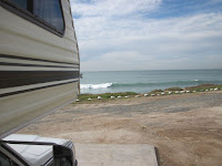
| Our first night right on the Pacific near Ensenada |
So far we've been having a great time, the scenery is beautiful, lots of cacti that we haven't seen before, rolling hills and sometimes really crappy roads. The people are very friendly and, luckily, we are being able to make ourselves understood even with our limited Spanish. We are also making friends with fellow travelers.
 |
| Cirio cactus |
There is only one main highway down through the peninsula. It is mostly well paved but only 2 fairly narrow lanes and no shoulder so you don't want to go too fast. There are sections that are in terrible shape with potholes, some of which are quite deep. You just have to slow way down so you can avoid them. Luckily the roads are not very busy, so we haven't run into any problems by being slow. And if someone wants to pass you, they will - on hills, on curves, in the face of oncoming traffic, you name it - a bit scary.
There are topes (pr. "toe-pays" - speed bumps) in some of the weirdest places, some of them are marked and some aren't. For instance, if you are coming upon a sharp curve there may be a series of topes approaching it to make you slow down and we mean really slow down! Some are quite tall and others are not, you never know. Most small towns that you pass through have several topes as you go along the main street, again some marked and some not. It's taken us a while to get used to them, be we haven't been caught out but once or twice early on. The tires and suspension are grateful to us for our caution.
There are topes (pr. "toe-pays" - speed bumps) in some of the weirdest places, some of them are marked and some aren't. For instance, if you are coming upon a sharp curve there may be a series of topes approaching it to make you slow down and we mean really slow down! Some are quite tall and others are not, you never know. Most small towns that you pass through have several topes as you go along the main street, again some marked and some not. It's taken us a while to get used to them, be we haven't been caught out but once or twice early on. The tires and suspension are grateful to us for our caution.
 |
| San Ignacio Mission |
 |
| San Ignacio cafe |
 |
| San Ignacio square |
One of our favourite stops so far, San Ignacio, is an oasis with a lake and lots of date palms surrounded by arid mountains. With the main attraction being an old mission, this quaint little town has a lovely shady town square. We really enjoyed our walk around the small town.
Traveling over to the east coast we came down out of the mountains into Santa Rosalia. The last bit of the road road was very steep and windy, and, as we approached town, was in terrible disrepair. We camped south of town and then spent the next morning wandering around. Alexandre Gustav Eiffel, of Paris Tower fame, designed a prefabricated iron-walled Church in Paris for the 1889 Paris World Exposition that, along with the Eiffel Tower, shared first place honors. Interestingly enough, Eiffel also designed locks for the Panama Canal and the framework for the Statue of Liberty.
At any rate, after the exposition it was dismantled and stored in a warehouse until the owner of a French copper mine in Santa Rosalia discovered it and had it shipped to Baja around Cape Horn. Also in town are some of the best examples of French colonial style architecture as well as many French-built wooden houses that are very quaint. We spent a morning wandering around the grid of narrow streets between the mesas, enjoying looking at all the different shops and houses. This was a copper town - the copper ore from the mine was shipped up to Washington state for smelting. Not wanting to come home empty, the ships brought back hardwood lumber on the return trip. It's very unusual to see so many wooden structures in this area. Our favourite shop was an old French bakery, we didn't just window shop there...Yum.

 |
| Mark made our solar panels tilt so we could catch more of the winter sun |
We are now camped on the shore of Bahia Concepcion, a national marine preserve. Along the shore are many beautiful beaches on which you can camp. Some people spend the entire winter in this spot. We were afraid it was going to be really crowded but so far we are not finding it so.
Our first stop was Playa Santispac. We've spent 2 days here and are enjoying walking the beaches and along the rocky coastline. There are 2 restaurants here, right on the beach, one even has wifi which is why you are getting this Khronicle.
Vendors wander up and down
the beach in the mornings selling various fresh foods, water, Mexican
rugs & blankets, etc. Cruising boats are anchored off the beach,
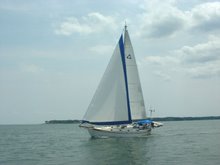
that's what attracted us to this particular spot. We've already met
and chatted with a couple of cruisers, so we're right in our element.
We
are half way down the Baja peninsula on the East side, wow this is a
really long piece of land, and we're really looking forward to seeing
more of it.


