01 November, 2015

Time is not on my side

Location: Tempe, Arizona

On our way across the US this summer, Time was pretty well behaved. We'd cross a time zone, gain an hour, make sure the GPS, phone, computer, Kindle, and travel alarm clock were all in agreement, and we'd be set until sometime in the future when we'd go through the exercise again as we continued to move West. It was all very predictable and we were okay with it.

Last month, we left California, crossed through Nevada, into Utah, and entered a different time zone. This time we lost an hour, but no big deal – we figured we owed it after all the gaining we did on the way out here. We willingly made the adjustments to the time on all the electronics.

But when we headed south into Arizona, Time started acting like a petulant toddler at bed time. Arizona doesn't do Daylight Savings Time (DST), so we were suddenly back on California time, 3 hours after Eastern time and 8 hours after English time. But we made the adjustments and carried on.

Then, still in Arizona, we entered the Navajo Nation's “Big Reservation”. The Navajos DO do DST, so we lost an hour again. Once again, we did all the adjustments and got settled in.

Heading North, back into Utah, Time was once again relatively well behaved until we crossed the border back into Arizona. This was followed by more kicking and screaming as we proceeded to cross back and forth between Utah, Arizona, and the Navajo Nation over the next few weeks. By the time we were done, we were thoroughly confused and had decided that, whatever the old Rolling Stones song says, Time is NOT on our side.

Finally, we settled in for a visit with one of Mark's old Copper Hill friends who lives in Tempe, Arizona. Time once again began behaving admirably, remaining the same as California, and 3 hours behind the East Coast.

That is, until this morning when Time pulled a fast one on us. Everyone else in the US reverted to Standard Time last night except Arizona, which was already there. Now, while we know what time it is here, we are, once again, not sure what time it is anywhere else.
 Obviously we're not the only ones who need time zone reminders - we saw quite a few signs like this.
 Speaking of time, we just had to insert these pictures from Petrified National Park - Look at the timeless strata in these hills
 225 million year old log
 225 million year old mulch

30 October, 2015

Ancient Americans

We have spent 3 weeks travelling through the Navajo Nation and Central Arizona seeking out as many ancient cliff dwellings as we could find. We've really learned a lot about the Navajo and Hopi, and their ancestors the Anasazi, Sinagua and Salado.

Most of these dwellings were built around 1000 AD and were abandoned around 1400 AD. The reason for their abandonment is currently unknown but the buildings have aged well due to the cover created by the caves in which they exist.

Our first stop was in the Navajo National Monument where we lucked up and managed to participate in a 5 mile guided trek to the ruins at Betatakin. 

The tour is only held once a week at this time of year. It is 700 feet down into the canyon for an up-close view of the ruins, built in an enormous alcove measuring 452 feet high and 370 feet across. 


Our volunteer Navajo guide, Jim Black, was awesome and not only gave us insight into the life of the Anasazi but also shared much about the Navajo culture.
 Next stop was Canyon de Chelly, which we viewed from several overlooks at the rim of the deep canyon. 
There were several ancient cliff dwellings, some of which couldn't be seen until they were pointed out to us.  
The Anasazis did a great job of camouflaging something that was in plain sight.


Then we visited Tonto National Monument where a great docent, Ryan, spent about an hour talking to us about the inhabitant's daily life and how the dwellings had been constructed.

These beams are original

Montezuma's Castle, named in the 1860s when it was 'discovered', has 5 stories and 20 rooms. Right next to it were larger, but less well preserved dwellings. 
 It is interesting that these native americans were building cliff dwellings during the period in Europe when magnificent cathedrals where being built. York Minster, for example, where construction began in 637 AD and ended in 1408 AD.

Unfortunately we have not yet visited the crown jewel of cliff dwellings – Mesa Verde – that will have to wait until warmer weather next summer as it's at over 8,000 feet of elevation. Brrr.

Below are a few odds and ends that may be of interest:
Can you guess which one is Julie? The Saguaro (pron. "sah-WAHR-oh") cactus is Arizona's state flower.
Navajo Dye Chart showing the plants used to create the beautiful colors in Navajo weavings
  Inside the Hubbell Trading Post established in 1828 and still trading incredibly beautiful Navajo rugs, blankets and much, much more.
 Inside the Hubbell Trading Post store
 Hubbell Trading Post barn
 We had to get a photo of this luxurious motor coach – note the sticker on the upper left corner. We figure “roughing it” is all a matter of perspective...

09 October, 2015

Pipe Spring, Arizona

 Continuing with our recent theme of avoiding the highest places in an attempt to stay warm, our next stop was Pipe Spring National Monument, Arizona. We're working our way south, but not too quickly; our friend, Michael in Tempe tells us it's still 104 F there and that's only 350 miles south.  So we're playing altitude against the heat against the changing seasons as we try to stay as comfortable as we can.  In the process, we discovered the Pipe Spring National Monument.  What a find!
 In the 1860s Mormon pioneers from Utah brought cattle to the area, and a large cattle ranching operation was established. In 1866, after Indian raids, a protective fort was constructed over the main spring.   Anson Perry Winsor was sent by the Mormons to operate the ranch and maintain the fort, which was soon thereafter known as "Winsor Castle".  This isolated outpost served as a way station for people traveling across the state and as a "tithing cattle" ranch. It also served as a refuge for polygamist wives during the 1880s and 1890s. 

Unfortunately, while affording protection to the white settlers, the fort also prevented the local Kaibab Paiutes from using the spring water that they'd depended on for many generations.  Although their way of life was greatly impacted by the Mormon settlement, the surviving Kaibab continued to eke out a living in the area and in 1907 the Kaibab Paiute Indian Reservation was established, surrounding the privately owned Pipe Spring ranch. In 1923, the Pipe Spring ranch was purchased and set aside as a national monument to be a memorial of Kaibab and pioneer life in the area.  A deal was negotiated between the Kaibab, the National Park Service, and the local ranchers to share the output of the spring equally.


We were treated to an amazing  pre-sunset


And an even more amazingly colourful sunset 


Recently, the International Dark Sky Association (http://darksky.org/), issued a press release naming the Kaibab Paiute Reservation as its first Dark Sky Nation. According to the press release, “never before has an entire group of ethnically and linguistically related people come together to collectively embrace dark-skies principles. As a result of the Kaibab Band of Paiute Indians’ work to protect the pristine night skies over its northern Arizona territory, IDA is pleased to announce the designation of the Kaibab Paiute Indian Reservation as an International Dark Sky Community. The IDA status makes the Kaibab Paiute truly the world’s first dark sky nation.” 

We were lucky enough to be there for the Kaibab band's inaugural Dark Sky celebration.  Complete with tribal leaders and singers, amateur astronomers, and the Bryce Canyon National Park Service's "Star Lab" inflatable planetarium, the event was a big success.  We even walked to and from our campsite under the light of the stars without a flashlight.  We had a wonderful time. 


Blooming Prickly Pear cactus 


The next morning, we took the park rangers up on their generous offer of the day before and harvested corn, carrots, yellow, hard, and zucchini squashes, green beans, and a jalapeno pepper from the monument's garden.  What a score!!


07 October, 2015

Bryce Canyon & Zion National Parks, UT


There are so many national parks in Utah we had a hard time deciding where to go. In the end elevation won out. The weather has been starting to cool off, warm during the day but just above freezing at night. We're not so excited about the cold so we just picked out a couple of places to go that were slightly lower in elevation. The first being Bryce Canyon.

 There aren't words to adequately describe Bryce Canyon. With it's red hoodoos (odd-shaped pillars of rock left standing from the forces of erosion), the canyon glows in varying shades of red to pink as the sun moves across the sky, painting the landscape with a breathtaking variety of light and shadow.
We walked the trail along the rim then plucked up our courage and decided to try the steep-sided trail loaded with switchbacks that leads down into the canyon. 

 The only downside was that we'd be walking a different, even steeper trail back up. It was totally breathtaking and totally worth it.


From the bottom looking up


From the top looking down 


Luckily we came across a small, inexpensive private campground close to the park and got to spend 2 nights running our little electric space heater to ward off the worst of the cold.


Zion National Park was our second stop. 


We walked a trail which we though was only .5 mile but accidentally got on the wrong trail which turned out to be 3 miles straight up a switchback trail with precipitous drop offs.  At least it was less busy!

This was the first park we've been to so far that had us saying "I'm not so interested in going back."

Why, you ask? Zion is supposed to be beautiful.
At Bryce Canyon you are looking down into the canyon from the rim. At Zion you are looking up from the bottom. Not so easy for taking pictures, these do not show how big and spectacular it is. There is also much less room to accommodate the enormous amount of people who visit the park, We just weren't expecting it to be so busy in the off season.


And to top it off, the parking lots were full – we luckily went into the RV parking lot and found a big spot with a short RV w/ just enough room for our little Toyota in front of it. If we hadn't found that spot, we would have had to park way out in town and take a bus in. All in all, we found Zion to be beautiful but a real disappointment.

05 October, 2015

The Loneliest Road in America

Location: US Route 50, Nevada – also known, thanks to a 1986 Life Magazine article, as "The loneliest Road in America"

Day 1
09:30 Sand Mountain Recreation Area – 2 miles long, 600 ft high dune open for off road vehicles

09:45  Hills
10:45 On the road
10:45 On the road
11:15 Bluffs
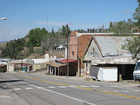
Noon  The town of Austin, once Nevada's second largest city with a population of 10,000, now a high country town of 300.  Very steep Main St.
13:40 Stopped for a nice walk and lunch at Hickison Petroglyph Park
15:17 Walked around Eureka and visited the only grocery store, Raines Market. 
The upper walls were covered in taxidermy. 
If they don't sell it you don't need it!
Several great old buildings in town, including a still running Opera house 


15:45 Still on the road


16:30 Camped for the night in a free Bureau of Land Management (BLM) campground

Day 2

8:45 On the road again, drizzly cloudy day


9:00 stopped to check out the Robinson Nevada Copper mine in Ruth - in operation off and on since 1907. Currently owned by a Polish Company.


Colourful mine tailings in Ruth.

10:00 Saw a steam train coming towards us right next to the road.  Totally surprised, we stopped and took pictures and a movie.

11:00 Stopped at the town of Ely where we toured Nevada Northern Railway National Historic Landmark.  The NNR first came to Ely in 1906 to transport copper and other ores. We were just finishing our tour when the steam train we had seen earlier returned.  We managed to tag along with the paying passengers for a tour of the maintenance shops and engine house.   Very, very cool.  We were thrilled to have happened across this gem. 

13:30 Snow on the mountain!?!
16:00 Camped in another free BLM campground - this one had a great 2 mile trail which we thoroughly enjoyed.


We have added the time lines so you can see how much this 300 mile stretch of road is the same yet so different.  Highway 50 follows much of the original Pony Express route across Nevada.  We spent  the 2 days mostly on long straight stretches of desert basin road, interspersed by winding up and down 17 mountain passes ranging in altitudes up to 6,800 ft.  We didn't feel lonely, just awestruck at the amazing, varied, and beautiful  scenery.  We'd much rather travel like this – you get to see and experience so much more than driving on the Interstate!