24 May, 2009

Elizabeth City and the Great Dismal Swamp

Location: Hospital Point, Portsmouth, Virginia
Position: N 36 50.742 W 076 18.044


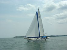
With the wind vane steering a good course on a close reach, we have a lovely, silent sail in 10-15 knots across the Albemarle Bay to the Pasquotank River and, finally, Elizabeth City.

On our way up the river we notice a huge building on the western shore. Later we look up and see a blimp hovering near the building.

Julie: “I wonder what that could be?”
Mark: “Maybe it’s a blimp factory.”
Julie: “Ha Ha. Yeah, right.”


Elizabeth City provides 14 free slips and a couple of bulkheads to which visiting boaters can tie up for two nights. If there are more than 4 new arrivals, the “Rose Buddies” put on a free wine and cheese reception! This has been going on for over 25 years – what a nice town!

We pick a slip, tie up, and go for a nice, long walk through the commercial district and the nearby old neighborhoods. Four more boats arrive, so at 4:30 we meander over to the Rose Buddies reception. There, we learn that the big building we went past earlier is, indeed, a blimp factory! All the blimps in America (except the Goodyear blimps) are made here!

We visit with the other boaters who have arrived then head back to the boat. When we get there, a voice message tells us Mark’s brother and sister in law are on their way to see us. We have a nice couple of days visiting with them, checking out the blimp factory, going for a sail, getting stopped by the Coast Guard for our first ever boarding (a random safety check – we passed), and catching up with each other – we haven’t seen each other since Mark’s dad’s funeral last fall.

Saturday morning we get up and walk about 50 few feet to the farmer’s market at the park behind the free slips. We buy four tomatoes, a bag of green beans, some zucchini, and some yellow squash – all for $4.00 – a good deal on some great vegetables. We say our goodbyes and head up the Pasquotank River toward the Great Dismal Swamp Canal.

The Pasquotank River above Elizabeth City meanders and narrows but retains plenty of depth. We pass logs covered with turtles, spot lots of different birds and trees, and watch the swampy bits slide past. Surprisingly there are no bugs. The shore closes in on us and soon we’re negotiating the turns with only 20-30 feet between us and the log and stump strewn banks on either side.

We reach the lock up to the canal a few minutes after it closes so have to wait a couple of hours for the next locking. We drop the anchor on a short rode, sit back, and relax. That’s when we see it – a huge mottled snake thicker than Mark’s arm lying on a stump sticking out of the water only about 20’ from the boat. Another boat arrives and we point it out – the captain says “That’s a cottonmouth.” Wow. Poisonous!!!

The lock opens and we enter and loop our lines around the bollards. The water begins to rise and we’re lifted about 8-10’ up, taking up the slack in our lines as Rachel rises to the level of the canal. The lock opens and we’re presented with a 100’ wide arrow straight strip of water. We pass a small town and tie up for the night at the Dismal Swamp Visitors Center – the only visitor center in North Carolina that services both auto and boat traffic. We have a nice short walk around the immediate grounds, then retire to Rachel for dinner and a quiet night.

In the morning we go for a longer walk on the board walk through the swamp, a winding trail through the woods, and along a dirt road that parallels the canal. It’s beautiful here, but we’re ready to get going again. At about 9:30 we release the lines and have a nice leisurely run up to the next lock.

As we’re locking through, dropping 12’ or so, the lock keeper walks by and spots Mark’s conch horn. He asks Mark to play it for him, then disappears for a second. He reappears with a colorful painted conch and proceeds to give Mark a series of lessons guaranteed to make him a better, more versatile conch player. “Conch Horn Bill” has a well deserved reputation for being one of the best conch horn players around, and Mark appreciates being “schooled”.

A few more hours and we’re anchored at Hospital Point on the Elizabeth River, Mile 0 of the Intracoastal Waterway with only another hour or two to go until we’re on the Chesapeake Bay.

11 May, 2009

Cape Lookout

Location: Cape Lookout, North Carolina
Position: N 34 37.825 W 076 32.401

After heading up the Cape Fear River and spending a lovely day with family in Wrightsville Beach we headed offshore on Mothers Day for a lovely sail up to Cape Lookout. We had heard from friends that it was a wonderful spot to anchor and wind down - they were absolutely correct. Cape Lookout is a National Seashore protected by the National Park Service. As you would imagine, it has pristine beaches and is totally undeveloped except for the old lighthouse and coast guard station and associated buildings.

The cape and its associated shoals are one of the most treacherous stretches of the eastern shore for passing ships. The coast of North Carolina between Cape Lookout and Cape Hatteras is known as “the graveyard of the Atlantic”. Because the land was so low a ship could be aground before realizing it so a lighthouse and a coast guard station were built there in 1812.

Behind the outer cape and its shoals is a large, deep bight of water teaming with loggerhead turtles. We spent our first night at the northern shore against Shackleford Banks, an island that is home to over 100 wild horses. As we dropped the anchor we could see some of them cantering along the beach. The next morning we dinghied ashore and enjoyed a long walk along the beach accompanied by a herd of 10 or so horses. We really needed the exercise after sitting on the boat for so many days!

Later we took Rachel to the south shore and anchored in 25 feet of water. The afternoon was spent in the cockpit reading and watching the loggerhead turtles swimming around us.

The next morning we set off fairly early and had another really long walk along the beach, through the now closed Coast Guard station and along to the lighthouse. The lighthouse is not open to the public but we looked around the lightkeepers house and its associated buildings then walked all the way back along the beach. We felt like our walking muscles were finally starting to get back into working order!

We moved on to Beaufort the next day but we definitely want to come back and spend more time here, Cape Lookout has earned a place on our list of favourite stops.

Mark & Julie
s/v Rachel

07 May, 2009

Landfall

Location: Southport, North Carolina
Position: N 33 55.039 W 078 01.690

With the Family Island Regatta finished we were on the fast track to get back to the US. After a couple of days waiting out high winds and seas we set sail with our new friends on Osprey and Magic. Our first day was a rolly ride up the Exuma chain. In the morning we caught another mahi in the deep water, so another wonderful dinner of grilled mahi-mahi was assured. Around noon we passed through Cave Cay Cut onto the banks side and the seas flattened out for the rest of the day. It was a long day but good sailing. We topped off our fuel and anchored off Sampson Cay for the night.

A fairly short hop the next day to Normans Cay gave us the opportunity for an afternoon ashore. Every chance for a walk and a swim is precious now as we won’t be able to enjoy this azure blue water much longer. Normans Cay has a bit of a nefarious history due to Carlos Lehder’s cocaine smuggling operation based there in the late 1970s and early 80s. (http://en.wikipedia.org/wiki/Carlos_Lehder).

The next day was another long downwind run up to Nassau – we all got out our spinnakers (those really colourful big downwind sails). It was a great sailing day. We anchored about 5 miles from Nassau at Rose Island, a very picturesque spot and had our final snorkel and swim of the season. Looking in one direction we could see the skyline of Nassau with it’s tall buildings and cruise ships, and in the other direction we saw white sand, coral reefs and desert islands reminiscent of Gilligan’s Island. We had a bit of a rolly night in the anchorage and none of us slept that well, probably due to anticipation of the 600 mile trip we were embarking on the next morning.

We like to do 3 hour watches on a passage and Osprey and Magic prefer 2 hour watches. We decided we would stay in contact on a single, nearly unused channel on the VHF radio. Because of our alternating watch schedule we had revolving people to chat with during our trip, making the passage back a bit more interesting than usual.

We weighed anchor 06:00 and the wind was dead behind us. This isn’t a great direction for Rachel since we broke our whisker pole (but that’s another story…) – so we ended up motorsailing more than we’d like. This was to be the case for most of the trip back. Every time we changed course to head further west, then north, then east, the wind changed direction and followed us, remaining dead behind.

At around 04:00 on the second day we were approaching Freeport on Grand Bahama Island, the other major city and port in the Bahamas. No chance of falling asleep on watch here as there were too many ships and lights to watch out for. A bit nerve racking but with all 3 boats watching out and chatting on the VHF we managed to pass by with no problems.

We now started to head NW and into the Gulf Stream – here’s where we’d make tracks, picking up a 3-4 knot boost in speed. It took us longer than we expected to reach the maximum flow, but eventually we were honking along at times making 11.4 knots over the ground (that’s really fast for us we usually do well to make 6.5) Once we hit ‘the Stream’ we headed North and now it was just a matter of riding it as far as we could. Of course the wind changed again, remaining behind us, and we continued to battle to keep the sails inflated in the rolly seas. Rolly is fine if all, you have to do is sit in the cockpit and look pretty but when you are needing to wash, sleep, prepare food, do the dishes, and use the toilet it’s not all that much fun!!

Every day we checked the weather and on the evening of day 2 the report was for the winds to shift to the north and pick up in a couple of days. At that point we decided we’d head for Charleston, about 100 miles short of Beaufort, our preferred landfall. We started to work our way out of the Gulf Stream. The next morning, as we were approaching Charleston, the weather mavens decided that the deterioration of the weather had slowed down so now it looked like we would have another day of decent weather. At the last minute we changed plans and direction and headed another 70 miles up the coast to Southport. For the last few hours in the early morning on day 4 we had to slow down to 4 knots or less so that we would not arrive before dawn. It’s definitely not much fun making landfall in the dark!! So at 06:00, 4 days and 4 nights and 630 miles after leaving the Bahamas, we were negotiating the Southport entrance channel.

Around noon the heavens opened and we had a huge thunderstorm and wind shift. Boy, were we glad we were in a safe harbour. We timed the weather just right!!

It’s hard to believe that just 8 days ago we were in George Town.