27 December, 2009

Connections

Location: Marathon, Florida

Position: 24 42.371 N 081 05.706 W

Well, the decision’s been made. We’ll sail from the Florida Keys to Isla Mujeres, Mexico whenever we get a decent weather window. We’re excited and a bit nervous. Our route will take us around Key West, past the Marquesas and the Dry Tortugas, south across the Gulf Stream to within 20 miles of the Cuban coast, then around the western end of Cuba, across the Gulf Stream again (it’s named the Yucatan Current here) and over to the eastern tip of Mexico’s Yucatan Peninsula (http://en.wikipedia.org/wiki/Isla_Mujeres).

It’s a trickier trip than we usually do and we want to wait for fairly settled weather. We thought we may be leaving tomorrow but now it looks like maybe Sunday. Or next week. We are all provisioned and ready to go - we just have to stock back up on the foods we are eating and wait.
Cruise ships in Miami


We left Miami just over a week ago in a flotilla of 5 boats. Four of us will travel together to Mexico and the fifth will spend the winter in Marathon. The trip took 2 full days travelling along the southern shore of the Florida Keys and was one of our best sailing trips yet. For both days we had 20-25 knot winds and because it was coming from the NW, the islands kept the seas from getting too high. For you non-sailors this is like having your cake and eating it too. We sailed, with no engine, for the entire 2 days. It was fun but COLD. I know you have no sympathy for us – you who are sitting there with snow on the ground thinking we are a pair or wimps. But!! Don’t forget even though the temperature was in the 50s F we were sitting outside all day with 20-25 knot winds blowing right on us. It’s not like sitting inside. We had our hats and gloves on, our jackets, foul weather trousers and …… our slippers. Still it was a great couple of days. It was very similar to sailing in Maine what with dodging the crab pots and the cold weather – except Maine was warmer!

At the end of December our cell phone will be disconnected and we’ll be back to staying in touch via ham radio. The radio is a godsend: using it we can send and receive small emails, download weather, and make calls around the world to friends that have ham radios. Occasionally we’ll have Internet access, so we’re able to use that to call our families, too.

Several of our boating friends have already headed over to the Bahamas and we’ve been staying in touch using our radio. There are a couple of “nets” in the mornings where we all check in and share our locations. During these nets we can hail friends and, after moving off the net frequency, we can have a nice chat. We have also set up some times and frequencies that we listen to and chat on in the evening, if we aren’t too busy socializing (and neither are they).


We are living a very simple life with few modern conveniences and our radio is our lifeline to civilization. Usually after dinner we turn on the radio and set it to our designated frequency. We either listen to see if any of our friends call, or we will initiate a call to them. Sometimes there’s a lot of crackling and interference and it’s hard to hear but other times it is as clear as day. We are reminded of our grandparents and parents sitting around the crackling ‘wireless’ listening to news and drama.

As we all are now heading in different directions this is our only way to stay in touch until we see each other again. This could be 6 months, a year or 2 years from now. However long it is, it’s already too long! We’re feeling a bit sad as we prepare to put more distance between us and our friends and families. We miss them, but we’re also looking forward to new experiences. We’re glad we’ll be traveling with some old friends and, as always, we’re sure we’ll be making new friends along the way. And we get to learn Spanish! “Ay caramba!!”


Khronicles – Keeping Kith & Kin Konnected!

12 December, 2009

Motivation

Location: Miami Beach, Florida
Position: 25 47.244 N 080 09.384 W

For some reason we just haven’t been feeling particularly creative or motivated Khronicle-wise lately. We’ve been busy moving south and getting Rachel and ourselves ready to go. We decided about three weeks ago to head to the Western Caribbean this winter. We’ll be going from Miami down to Boot Key Harbor / Marathon, Florida. We’ll stick around there waiting for weather and, when the time seems right, cross the Gulf of Mexico westward to Isla Majeras (Mark says “That translates to ‘The Island of Women’!!”) off the Eastern tip of the Yucatan peninsula in Mexico.

The current plan is to hang out there a bit then work our way down the Mexican coast to Belize.

Our “week” in Vero Beach, Florida turned into eleven days. Our “few days" in Miami Beach, Florida has turned into a week so far with more to go. We have begged, borrowed and purchased cruising guides, charts and courtesy flags for all the countries we know, think, or there is even a possibility we may go to. We have worked on Rachel to prepare her for a long period away from spare parts. We’ve stocked her to the bursting point with food items that we may or may not be able to get. And then there’s the wine!!!

So it’s not that we haven’t been busy. Of course, along with making tracks down the east coast of the US we’ve also been visiting old friends and making new ones. We know we say this often but hanging out with friends is one of our favorite parts of the cruising lifestyle.

All that being said, Miami (spelled backwards it’s “I maim” – go figure) is a great place to sit at anchor. Easy shore access, easy provisioning and lots to do.

Mark: “Think ‘South Beach’”.

Julie: Whack!!

Mark: “Ow! Whaaat??”

And to top it off a friend just turned us on to this fantastic little Cuban restaurant over there that does breakfast for $3.65 – and that includes the coffee!

Miami is the farthest south on the east coast of the US we’ve been in Rachel, so we’re looking forward to seeing and experiencing new places and meeting new people. Once we get on our way again we’re sure we’ll be motivated to share our experiences with you all. Honest!


Mark & Julie
s/v Rachel

http://svRachel.blogspot.com

01 November, 2009

Snails on a Turtle

Location: West Hartford, Connecticut
Position: N 41 47.06 W 072 45.66

Rachel is in a slip in Isle of Palms, South Carolina and we’re in a rental car driving up to Connecticut. Headed up the interstate highway at 70 mph we find ourselves reflecting on the differences between travelling by land and by sea. We just spent over two months getting Rachel from New England down to South Carolina, and now we’ll be making the return trip in 15 hours.

As we speed north in our rental car we recall looking out from Rachel’s cockpit at turtles sitting on rocks and logs, plopping into the water as we passed by along the Waccamaw and Pasquatank Rivers. From the car, even if there were turtles, we wouldn’t be able to see them at the speed we’re travelling. It’s all relative….

Q: What did the snail say when it was riding on the turtle?

As we cross the narrow, tame, and shallow upper Cape Fear River in North Carolina we remember the morning we sailed down its lower reaches. It’s turbulence and fast moving current created eddies and whirlpools as we sped along at 7.2 knots (just over 8 mph).

A: “Wheeeee!!”

Passing a sign that points the way to Wrightsville Beach we remember the huge dolphin that swam up to play in our bow wave as we sailed down from Beaufort, North Carolina (pronounced “bow-furt”). His nose reached out beyond Rachel’s bowsprit while his tail was right next to her hull, probably around 7 feet long. Julie spent the longest time standing on the bowsprit watching him. He kept looking up at her, too, as he swam and played.

We pass another sign telling us we’re entering the Pamlico Sound Watershed. It’s sunny, warm, and still here. Far different from the day we left Ocracoke Island bound for Oriental in the blowing rain. We had to clear the shallow Ocracoke entrance channel directly to windward, pounding into the waves and taking green Pamlico Sound water over the bow. Intracoastal Waterway

Driving over the upper reaches of the Potomac River, upstream from Washington, DC we see a river that, if navigable at all, would require a canoe or kayak to weave between the shallow rocks. We are reminded of one of our problem spots on the Chesapeake. The Potomac River flowing into the Bay causes a lot of turbulence and steep, choppy waves, especially when the wind opposes the ebbing tide. This is where the wooden dinghy we built in our basement first broke during a night passage to Mobjack Bay. Different, but just as scary as the political turbulence in the US Capital. Hmm. On second thought, maybe the Potomac isn’t so bad as all that ….

We cross the Delaware Bay Bridge (paying one of many annoying tolls along the way) and remember our glorious sail up the Delaware Bay and through the Chesapeake & Delaware Canal to the C & D CanalSassafrass River on the Chesapeake Bay with the wind and tide in our favor all day.

Along the New Jersey Turnpike and Garden State Throughway our sightseeing is interrupted by toll booths, large trucks, and annoying drivers. How different it is rushing along in this semi-organized chaos than when we sailed past Atlantic City on that lovely moonlit night! Silently rocking along looking at the giant wind generators, all the lights from the tall buildings, and watching Harrah’s of Atlantic City become a building-sized video screen (http://www.youtube.com/watch?v=AzkrbnByY-k&feature=related).

We pass New York City, looking at the tall buildings in the distance. From here in a car you can’t really even see the City – certainly not as intimately as we did from Rachel’s deck as we sailed the East and Hudson Rivers.

One thing we have been pleased to notice as we continue to travel north is the awesome colors of the autumn leaves. The leaves have turned since we left New England a couple of months ago. The reds, yellows, and oranges become ever more vibrant as we approach New England. Lately, most of the scenery we’ve seen from Rachel has been cypress swamps and marsh grass – different, and every bit as beautiful in their own ways – but these New England autumn colors … wow!

Woven throughout all of this are thoughts of old friends with whom we travelled, new friends we made along the way, and friends we haven’t seen in a while who are either behind or ahead of us in our travels. These friends, the ones we haven’t yet met, and the moments of solitude we enjoy - whether alone during a solitary night watch or together like we are most of the rest of the time - are the real highlights of our life aboard and are precious to us.
Spending the night in the Dismal Swamp, North Carolina
All in all we agree that we prefer travelling on Rachel over travelling by car. We have more time to think, to look, to consider, to relate. You know that whole “it’s not the destination, it’s the trip” thing? Well, it’s true. At least for us. Some may look on our life as slow and boring – “how can you stand to sail all day and only travel the same distance you can in less than an hour in a car?” We actually like – really, really like - being “snails on a turtle” and can’t wait to get back aboard Rachel to resume our slow passage further south.

“Wheeeee!!”

19 October, 2009

Catching Up With Friends

Location: Broad Creek, near Oriental, NC
Position: N 35 05.446 W 076 37.960


Okay, we’re finally getting sick of being over a month behind in our Khronicles (“It’s about time!” you say). Therefore, we’re going to subject you to yet another round of playing “catch up” as we flounder our way back to the present.

Carter our tourguideWe last left you in Port Jefferson, NY, following our hair-raising escape from “no show” hurricane Danny. After spending a couple of days in Port Jefferson it was time to head down through New York City. You may recall that on our way north in the spring we wished our friend Carter, who lives in New York City, could have been with us. We called and were happy to learn that she was available. She caught the train to Port Jefferson, spent the night on Rachel, and gave us a personal guided tour as we traversed the East and Hudson Rivers through the city the next day. She left us at Atlantic Highlands, NJ where she caught the high speed ferry back home. Thanks, Carter, it was a great day!

We spent a couple of days in Atlantic Highlands wandering round the back streets and old neighborhoods. Stocking up on groceries and diminishing the laundry pile were high priorities, both of which we managed to accomplish.
Statue of Liberty
The weather forecasters said it was time to leave so we sailed and motor-sailed overnight down the New Jersey coast in light winds and caught the tide all the way up the Delaware Bay and through the Chesapeake & Delaware Canal into the Chesapeake Bay. We travelled a total of 200 miles in 32 hours, another great trip. We anchored in the Sassafras River in the northern part of the Chesapeake Bay for the night, then headed further down the Chesapeake.

We stopped to see friends who were near Baltimore repowering their boat (putting in a new engine for you landlubbers). We ended up staying there for 2 weeks thanks to the generosity of their friend who let us use a slip. Our time was spent busily sanding, epoxying, replacing the genoa tracks, painting and varnishing the shower, and generally improving our Rachel. Thanks, Ken!

During the third weekend in September we attended another SSCA gam, this one in the Rhode River near Annapolis. Following that we cruised a little with friends then visited our old stomping grounds in Deltaville, Virginia. As always, we were looking forward to seeing friends there in our old “home port”. We also picked up our mail and managed to get invited to a lovely dinner. Thanks, Jon and Anne! A submarine passing us in the Chesapeake

Now it was getting colder - time to start heading south in earnest! We headed south via the Dismal Swamp, one of our favorite parts of our trip north in the spring. The only problem with traversing the Dismal Swamp is that sometimes it is not deep enough for our 6 foot draft. Some friends on another boat told us they’d seen depths of “nothing less than 7.5 feet” a week or so before, so we decided to give it a go. After several bumps and a bit of plowing, we made it through and headed down the Pasquotank River to Elizabeth City. We really liked this town on our way north and certainly enjoyed it again this trip. We got to see the local high school’s homecoming parade and attend the free “Rose Buddies” wine and cheese social our first night there. Thanks, Elizabeth City!
Dinghy railway to lift the boat up to the level of Lake Drummond, Great Dismal Swamp
We left Elizabeth City and, in company with two other boats, had one of our best sails of the year (though it was a bit chilly and overcast) to the town of Manteo on Roanoke Island. We’d hoped to spend a couple of days there, but the weather forecasters gave us one good day followed by several lousy ones. We decided that passing through the shallow channels around Roanoke Island and Roanoke Inlet in fair weather was far preferable to doing it boisterous conditions, so we left at dawn the next morning. Sixty miles later we anchored in Silver Lake at Ocracoke Island in North Carolina’s beautiful Outer Banks.

We’d been hearing about how wonderful Ocracoke is for years, but this was our first chance to see and experience it in person. It’s a beautiful island that is mostly national seashore. The small town of Ocracoke on Silver Lake consists of many small lanes with a generous sprinkling of cottages and small shops. We spent many hours wandering around in town and on the beach, nature watching, window shopping, and generally enjoying ourselves in spite of the blustery, rainy weather. Though we’d only planned to spend a couple of days there, our stay was extended to four days by 20-25 knot winds – not that we minded! Thanks, Ocracoke!

Finally catching us up to the present (“And it’s about time!” you say), last Friday we sailed from Ocracoke in 15-20 knots. With the wind on the nose we fought our way out through the short steep waves in the entrance channel at Ocracoke, occasionally taking green water over the bow. After our turn to the west, however, we had a glorious reach across the Pamlico Sound and up the Neuse River toward Oriental (“Aha! I know what a “reach” is!” you say).

Beautiful Broad CreekThanks to the generosity of more new friends, we’re staying at a slip here while we wait for the cold weather and yet more strong northerly winds to pass. Even though there’s a frost warning tonight, we’re as snug as can be while our little electric space heater pumps out the BTUs. Thanks, Jerry and Donna!

And now we’re caught back up. We should let you know that we still retain the right to backtrack, tell a few tall tales, and fill in a few details in later Khronicles, but at least we can continue moving the Khronicles forward with clear consciences.

Last, but not least, we wanted to thank you for reading this. Your comments, observations, suggestions, corrections, etc., mean a lot to us. We appreciate you letting us occasionally interrupt your day with our natterings.

Thanks, friends!

28 August, 2009

Big Bad Bill

Location: Port Jefferson, New York
Position: N 40 57.830 W 073 04.909

Hurricanes are a big deal wherever you live. But if you live on a boat, they can easily (and quite literally) become life changing experiences. We haven’t lived through one on Rachel and have no desire to do so.

So here we are sailing down to Harpswell in Casco Bay, Maine and keeping a close eye on the tropical storm system forming to the east of the Windward Islands in the Caribbean. There’s a family gathering scheduled at which Mark’s dad’s ashes will be sprinkled at his favorite fishing spot in Maine. The prediction is showing that Bill will skirt the coast of Maine within the next few days. Even if the storm passes 50 miles offshore we can look forward to high winds and huge waves. We study the charts and find a potential hurricane hole just inland from Harpswell where we think we can hide if necessary.

A good hurricane hole has all around protection, preferably with high sides (so the winds will skip over you), good water depth (in case huge waves come in and try to bonk you on the bottom), and most of all, good holding for your anchors. When we arrive at Harpswell the first thing we do is go a bit further inland to check out Long Cove. Apart from it not being as deep as we’d like we’re confident it’ll make a fine hurricane hole, so we head back to Harpswell Sound.

When we express our concerns to the locals we’re told “Hurricanes don’t usually hit Maine”. Oh. Okay. Well, our experience further south says that if a hurricane even so much as threatens landfall anywhere near, all the available hurricane holes get filled to (or most often beyond) capacity. When this happens, there’s “no room at the inn” and you could be caught out at the worst possible time. We want to be proactive and make sure Rachel is safe, so we check the updated weather at least twice a day, ready to make tracks for our chosen spot if the worst should appear imminent. So far, the forecasts still show Hurricane Bill skirting right by or over us.

We do not let our worries prevent us from having a great time at the spot in Maine where Mark spent some of the happiest times of his life. (Editors note: that would, of course, be before he met Julie!!). We enjoy many wonderful, happy hours with his family, chatting and reminiscing.

The scattering ceremony is scheduled for Saturday, but unfortunately Bill is scheduled to arrive early Sunday morning. The forecast is for high winds and building seas on Saturday - not the most conducive forecast for a family heading out to a rocky island on a small boat. Still we wait, hoping that, at the last minute, the storm will veer further out to sea and give us a miss.

The Friday forecast shows the storm weakening slightly and heading a little further offshore. Huge sighs of relief all round. After much discussion we decide that the hook of land behind which we lie, just off the old family cottage, will give us enough protection from the predicted 40 mph winds and 10 foot seas - so Rachel stays put.

On Saturday morning Bill slows down a little; enough so that we decide to go on out and say a last goodbye to Mark’s dad, Ken. The rain holds off long enough for us to have a lovely outside gathering and remembrance of Ken’s ‘pretty good life’. Our ride out to the island and back on Mark’s cousin’s son’s lobster boat (wow, that’s a mouthful) is another highlight for Mark – he hasn’t been on one since he was a teenager lobstering with his uncle Ned and the memories come flooding back. Thanks, Chip.

Finally, on Sunday, the rain comes. Fairly high winds and big seas pound the islands to the south and east of us, but Rachel is safe and secure in her anchorage seeing almost no storm-related weather other than the rain. By Tuesday the seas are down and we head further south into Casco Bay to meet our friends on Barefootin’ at Jewell Island, having decided to head back south together.

We have a lovely sail down to Kittery, Maine. When we arrive our friends tell us “Just in case you haven’t had enough excitement yet, another tropical storm named ‘Danny’ has formed and it’s also forecast to head our way.” Crikies.

Danny is predicted to increase to class 2 hurricane strength and clip Cape Cod a glancing blow. Like Bill before him, Danny will run up the coast of New England and also clip the coast of Maine. How close is anybody’s guess. We decide to get moving again to both get south and to minimize our exposure to the storm. Since we’re only 75 miles north of Cape Cod, we decide that if we leave immediately we can get down to Cape Cod, through the canal, and then as far west as we can into Long Island Sound before Danny makes landfall. The further the better, since further west is more out of Danny’s predicted path.

So we haul anchor at 4am and start heading south. We’ve been looking forward to enjoying a nice, relaxing trip south. Yea right!! Not so much. It ain’t gonna happen. Instead, feeling the stress to make good time and stay one step ahead of the storm, we forge ahead. It’s expected to hit Cape Cod head on in three days and we only travel at 6 mph. Yikes!

We get through the Cape Cod Canal in the late afternoon and are thinking we’ll stop and spend the night then continue on the next day.

Once again this will not be so. We check the storm track again and have a discussion with our friends. Danny’s still on track to smash into Cape Cod. It’s 75 miles down Buzzards Bay to the entrance of Long Island Sound and an additional 50 miles to Port Jefferson, New York. That’s 20 hours at 6 knots - and we only have 48 hours left. There’s no time to stop and sleep; we need to keep on moving. We travel through the night, now feeling good that we are making miles west and away from danger. We enter Long Island Sound at first light and make it to Port Jefferson by 5pm. An awesome run! We had the current in our favor the entire 214 mile trip except for the last 6 hours – 6.74 knots average speed for the entire trip! This is a record for us on Rachel. Now all we can do is set the anchor with a lot of chain and try to get some sleep before Danny arrives tomorrow.

As it turns out, Danny loses strength and heads a little further offshore than originally predicted and, once again, we only get some rain and not much wind. We could get frustrated that we’ve made all this effort and the storm has once again changed course, but we don’t. Instead, we’re grateful because it could easily have headed further west and hit us hard. We feel that we have made it to a safe haven and, as we all know, you don’t want to fool around with Mother Nature.

After spending a day resting up and waiting for the winds to die down we reflect on our passage. We‘ve had a lot of stress and a long, fast trip, but the good part is, we’ve also made lots of progress! Now it’s only a hop, skip, and a jump (a mere 250 miles) to get us back to the Chesapeake Bay!

As Mark’s Dad used to sing “Big Bad Bill is Sweet William now.”

Wishing Sweet Williams to us all,

15 August, 2009

A gem …. or three

Location: Isle of Springs, Maine
Position: N 43 51.830 W 069 40.717

During our sailing about, we like to try and visit places that are a bit off the beaten path. Sometimes these are disappointing, but more often than not it’s been our experience that these spots often have something unique and wonderful to offer us. And every once in a while we come across a real gem. Or three.

We left the Penobscot Bay and headed toward East Boothbay to visit Mark’s cousin – she had lined up a free mooring for us for a few days. As we pulled in to pick up the mooring we noticed a pretty little wooden day sailor on the mooring next to us.

Mark’s cousin’s daughter’s boyfriend (Eben) rows out to welcome us. His dad, Nat Wilson, has loaned us the mooring. Nat is known world-wide as a traditional sail maker. He made the sails for the USS Constitution and many of the old Hereschoff boats (the 3 remaining Buzzards Bay 30s for example) among others. The little boat on the mooring next to us was a 1912 Hereschoff 12.5 they were working on.

typical Maine islandAnyway, back to the story. Eben asked us if there was anything we needed and Julie sort of joked that we’d been thinking about putting a third reef in the main sail. He said “Oh. Let’s take a look.” So we raised the sail to the second reef. Then he said “Let’s take it off – I can take it up to the loft, cut the patches this afternoon and sew it up in the morning. It’ll be done tomorrow afternoon.” Wow! We were stunned! We finally found a sail loft that wasn’t going to make us wait three weeks or a month to do the job!

And he was true to his word – the next day we had a third reef in the main – and the quality of the work is top notch. When we went in to pick up the sail Nat showed us around the loft and told us “Feel free to pick up that mooring anytime if it’s open.” What gracious and helpful hosts, and what a gem the Wilson sail loft turned out to be.

After a wonderful visit with Mark’s cousin and family, we left East Boothbay and headed briefly north to the Muscungous Bay and spent the night at Harbor Island. This is yet another beautiful spot in the long string of beautiful spots we’ve discovered in Maine. Another lovely hike around the shore, across the cliffs, and through the woods followed by another delicious dinner on Rachel. We sat in the cockpit having a glass of wine and decided that Harbor Island qualified as another gem. These islands are very similar, pine trees, rocky shores to pick your way around hopping from rock to rock, they are also very different and each enchanting in it’s own way. We have only touched on a few but will save others for another trip.

Outward Bound boatWhile we watched the sun set and the sky begin to darken, we noticed two open boats rowing in. Four pairs of oars each, eight people rowing in synch (because there’s not a breath of wind), one on the tiller, one working the lead line, and a few more milling about, they came in and dropped their anchors near us. Upon questioning, we learned that they were Outward Bound boats out for the 4th night of a 12 day voyage. After they settled in they stretched a tarp over a boom and bedded down for the night. The big question we had was “how do they work the toilet issue?”, since there are both girls and boys on each boat, and there’s obviously no room for a proper head. Unfortunately, that question was left unasked, so we may never know.

We hauled anchor in the morning and started south for the Sheepscot River. Julie wanted to see puffins, and puffins we were going to see. As she told some friends “I’m going to make Mark circle Eastern Egg Rock until I see one! However long it takes.” Needless to say, Mark was less than thrilled with this idea. The cruising guide tells us there were 23 nesting pairs there in 2003. We get there and begin our first circle. Wow. Those nesting pairs must have been really busy because there are puffins everywhere! Mark got away with circling the island once, Julie got all puffined up, and we all got to start heading south.
Island emerging from the fog
The anchorage off the Sheepscott River at Isle of Springs is on the northeast side of the island, providing excellent protection from the usual southwesterly winds. On the spur of the moment we decided to stop there and go for a walk. What a treat. It was like going back in time.

There’s one truck on the island and it’s only used to pick people up at the dock when they arrive with their luggage and groceries and to take them back when they leave. Other than that it sits idle. The rest of the time everyone uses dock carts. There’s a small ferry provided by the homeowners association, who also owns a lot on a nearby island that’s accessible to the mainland via a bridge. Everyone parks their cars at the lot and catches the ferry to the island. Then they walk. And smile when they pass. They know you’re not from there, because they know everyone who is. But they smile and are gracious, anyway.

The island is crisscrossed with paved paths, wooden boardwalks, gravel walks and woodland trails. It’s not too big, but it’s stunningly beautiful. Smaller, turn of the century cottages are scattered about and there’s a big community hall called “The Casino” next to the tennis courts at the top of the hill.

There was a list on the Casino of who was going to do the Sunday service. The residents take turns – last Sunday the kids did it. We’re sorry we missed that one – bet it was great! There were two pianos there – one was labeled “For General Use” and the other was covered by a sheet. There’s also a phone tree list – if an emergency occurs, everyone is responsible for calling two or three others so everyone gets notified quickly. There are even a fire pond, piping, and fire hose stations scattered around the island. But no stores. If you want to spend money you have to go to the mainland. Cottages are handed down from one generation to the next and only rarely will one be offered for sale.

There’s an honor system library – it used to be the post office until the USPS closed it a few years ago. When you want a book you check it out yourself. Then you’re responsible for returning it in a timely fashion.

seals sunning themselvesAfter spending an afternoon and the following morning walking around on all the trails, soaking up the sun and the smells and the sounds, we met a woman who was down at the dock with her daughter and her daughter’s friend. The kids were jumping off the dock (10 or 12 feet above the water!), swimming and having a ball. Our new friend told us that her parents own one of the cottages. Then she said something special. She said “My daughter’s experience here is almost identical to my mothers and to mine. It’s wonderful to have such continuity.” Time suddenly slowed. Mark was transported back to his childhood summers in Harpswell. What a wonderful place to be a kid!

Our new friend was intrigued that we live on Rachel and wanted to know all about it. We traded email addresses and she made us promise to come up to “The Farmhouse” for drinks next time we visit. We assured her we’d be back and are looking forward to returning the next time we come back to Maine. Having added this little gem to our collection, we take our leave, looking forward to discovering the next one.

Fair winds,

06 August, 2009

Reaching

Location: Winter Harbor, Vinalhaven, Maine
Position: N 44 05.736 W 068 49.118

We love sailing. On Rachel we especially love reaching.

For you non-sailors: Imagine looking down at the boat from the top of the mast and thinking of it like a clock face. The bow is at 12 o’clock and the stern is at 6 o’clock. If the wind is coming from 2 o’clock (or 10 o’clock), it’s called a “close reach”. If it’s coming from 3 o’clock (or 9 o’clock) it’s called a “beam reach”, and if it’s coming from 4 o’clock (or 8 o’clock) it’s called a “broad reach”. These are Rachel’s fastest and most comfortable points of sail. We’ll sail on a reach every chance we get – even if it means going a bit out of our way.

There’s a well known channel between Deer Island and the mainland named the “Eggemoggin Reach”. It runs NW to SE and, since the prevailing winds are out of the SW, you are able to “reach” in either direction for a glorious sail. Mark has been wanting to sail the Eggemoggin Reach since we began sailing “just because”. It’s something we’ve really been looking forward to and we’re finally here!

Here are the log entries from our two trips (up west and down east) on the Eggemoggin Reach:

28 July – Finally on the Eggemoggin Reach. Unfortunately there’s no wind, so we’re motoring with just the main up.

3 August – No wind – motored the length of the Eggemogin Reach. Again.

Sigh…..

It hasn’t been all fog and no wind, however. We’re sitting here in Rachel’s cockpit after a wonderful sunny day of sailing (yes, sailing!!) through Merchants Row and East Penobscott Bay. We look out at the world around us. Two schooners – the “Nathaniel Bowditch” and the “Liberty Chimes” are sharing the anchorage with us. They’re gorgeous.

One thing about Maine – there are a whole lot of really beautiful boats up here. Old wooden sailing dinghies, schooners, ketches, yawls, sloops, runabouts, trawlers, lobster boats, you name it. We figure with only a few months of sailing season, the rest of the year can be used for doing stuff like varnishing. Whatever the reason, it’s always fun to look at all the boats

There’s absolutely nothing like a sunny day in Maine – crisp and clear as far as the eye can see. Blue skies with small, fluffy white clouds, evergreen covered cliffs, green water, and waves breaking on the rocks. The smells of balsam and the sea. Warm sunlight drying out the dampness in the boat and making us drowsy. It just doesn’t get any better than this, and the foggy, rainy, windless days make the sunny ones like this all the more precious and wonderful.


Happy to be here,

04 August, 2009

Mainly Maine

Location: Frenchboro, Long Island, ME
Position: N 44 07.472 W 068 21.653

One of the wonderful things about Maine is you never know what to expect. When you wake up in Rachel in fogthe morning you could find a thick fog or, just as likely, a glorious sunny morning with the water twinkling and the trees backlit with the rising sun. You plan to travel and it could be thick fog, or it could be a glorious sunny day with perfect wind for sailing. You plan to go for a hike up a mountain and it could be such thick fog you can’t see the next tree or it could be a clear sunny day with miles of visibility overlooking small tree covered islands, mountains and seas covered with lobster buoys. That’s why people keep coming back because, like England, on a glorious summer day you just can’t beat it.

We have just spent three days in Long Island, only 6 miles around and 7 miles from the mainland. The only town on the island is named Frenchboro and it is purely a fishing village. People here are friendly, they really seem to like visitors but they do not cater to them. The harbour is small and full of moorings for lobster boats, with a few moorings for visiting cruisers. There was one left when we arrived but, since we prefer to anchor when we can, we left it for the friends we were traveling with. We anchored just outside the harbour in a protected but very currenty channel between two islands.

There is no grocery store. All the islanders must catch the ferry to the mainland for that. No quaint Frenchboro Harborlittle shops. There is a fuel dock and deli where you can buy from a minimal sandwich selection, lobster, of course, drinks, and deserts. A lovely museum and library, a post office and a one room school with 13 students ranging from kindergarten to 7th grade (5-13 years old). Almost everyone here is a lobster fisherman and the year round population is 43 at last count.

This year another business opened in competition with the sandwich shop. I’m sure that is a big deal and probably caused a little stress in the community. The new café is called Offshore Store and More and is run by Tammy and her husband John, he’s also a lobsterman. The store also sells from a small menu but of course the popular items are the over-stuffed lobster roll (on a homemade roll) and lobster freshly cooked, which they will deliver to your boat, for $4 a pound. We can attest to the fact that both items are utterly delicious!
Wild Orchid
Frenchboro is like taking a step back in time, kids are all over the one street town playing on bikes, playing in the mud flats at low tide just generally having fun. The ferry only comes 3 times a week, Tuesday, Wednesday and Saturday. So if you want to go shopping you have to take the Tuesday ferry and stay overnight on the mainland, do all your shopping, and then return on the Wednesday ferry.

Tammy told us that when school is in the kids all come home for lunch. So whichever mom has not taken the trip to town is ‘the Mom for the Day’. All the kids come to her house for lunch, and again after school until the dads return from lobstering.

BeachWe have really enjoyed our time here, although it’s hard to imagine what life is like here in the winter. A few years ago they came up with an incentive programme to get more people to move here. A few families took the offer, but only one family has stayed. In recent years a large plot of land came up for sale and there was talk of subdividing and building houses. The town got together and managed to raise enough money to buy the land for a conservation programme and now over half of the island is in its natural state and covered with wonderful walking trails. The residents are happy with their small, sleepy village, they like tourists and cruisers to come over to visit and are happy to see them but they don’t want their island turned into a tourist mecca, they like it just the way it is…….and so do we!! We will definitely make another stop at Long Island next time we’re in Maine.

24 July, 2009

Blueberries

Location: Somes Harbor, Mt. Desert Island, ME
Position: N 44 21.623 W 068 19.649

Mmmmm…blueberries. And not just any blueberries. Low bush Maine blueberries. Have you ever had any of these? They’re pretty small – a large one runs about 3/8” in diameter and most are about 1/4". But the flavor. Oh my.

We couldn’t have timed our visit to Mt. Desert Island and Acadia National
Park any better if we’d planned it. It’s the height of blueberry season here and the hills are covered with the delicious little blue orbs. To top it off, every time we hear the local pronunciation of the island’s name (“dessert” not “desert” – the emphasis being on the second syllable) our mouths begin to water in anticipation of the mountains of dessert we’ll soon be making.

Mt. Desert Island is home to a majority of the land in the Acadia National Park, one of the smallest, yet most popular parks in the national park system. More than 3 million visitors come to Mt. Desert Island every year. One of our cruising guides says “People come from everywhere to see this beautiful island, this granite-hard, fog-softened, primeval meeting place of land and sea.” Luckily, most of these tourists arrive by car (and seem to spend most of their time there). This leaves the mountainous hiking trails relatively uncrowded.
View from the top
Our home base is in Somes Harbor at the northern end of Somes Sound, the fjord that nearly bisects the island. We’ve been anchored here for four days so far, and are looking forward to spending a few more days here. From Rachel, we can row the dinghy in to the public dock and walk up the short road past some beautiful gardens and fields full of wildflowers to the main road. There we stand until one of the free buses that run every hour to Bar Harbor passes. We flag it down and ride it in to town. From the village green we can take any of 7 different bus routes around the island and through the park.

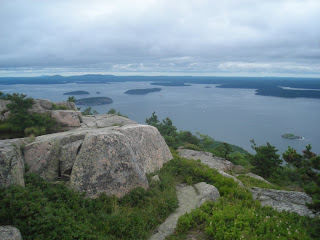
Yesterday we got together with our friends on “Osprey” and went for a hike in the park. After some discussion with a couple from a neighboring boat who have come here for years, we decided upon the Bear Brook Trail which runs north-south and crosses Champlain (1058 ft.), Halfway, and Gorham (525 ft) Mountains. It’s a 4 1/3 mile trek rated as “moderate” in the trail guide. It turned out to be just right. We got to do a bit of scrambling, a lot of up-and-down hiking over rocks (good workout for the knees), and some forested paths that took us along the banks of a beaver pond. Along the way we found patch after patch of blueberries.
Mark picking berries
At around noon, after we’d crested the top of Champlain Mountain, we stopped, rested, and ate our picnic lunches. After our lunch break we started collecting berries as we walked along. Kayo and Birdie, the “Osprey” kids, would run on ahead and find the “Oh my gosh! The mother lode!!” berry patches. The adults would catch up and all six of us would spend a few minutes harvesting the biggest and bluest berries we could see. This continued on and off for the next hour or so until we’d collected several pints. For the remainder of the walk any berries picked went directly into our mouths. You could tell by all the blue tongues that we got our antioxidants for the day!

Just as we were running out of steam we arrived at the end of the trail. Happy, tired, and a bit achy, we lolled around on the shore side of the road park loop watching the ocean waves roll in until the bus came by to take us home.

In all, Rachel’s crew collected about two pints of berries. All that remains now is for us to decide how to prepare them. There are so many choices. To paraphrase Bubba in the movie “Forrest Gump”: “You got blueberry buckle, blueberry cobbler, blueberries in yogurt, blueberry muffins, plain old blueberries, blueberry pancakes, blueberry trifle, blueberry pie, blueberries and cream, blueberry duff, blueberry scones, blueberry bread, blueberries on cereal, blueberry waffles, blueberries in custard, blueberry tarts, blueberry twists, blueberry syrup, blueberry donuts, blueberry cupcakes, blueberry ……….”The Haul

21 July, 2009

Heading to Maine

Location: Somes Harbour, Maine
Position: N 44 21.623 W 068 19.649

We did it again. We’ve been having so much fun we haven’t been keeping you in the loop. Sorry. It’s a tough life, but somebody’s got to do it.

Here’s the quick account of our last few weeks. After sailing through New York City we made a couple of stops and ended up in Hamburg Cove, Hamburg, CT, about 8 miles up the Connecticut River where we put Rachel on a mooring and went to visit Mark’s mom for several days.

After a lovely, albeit very busy 6 days with her, we returned to Rachel, slipped the mooring, and headed to Point Judith Pond, just south of Wakefield, RI to spend a few more days visiting with some cruising friends. It was a great visit – they even took us to that cruisers paradise, the “3 for $10” wine store!

After dinner one night on their boat and dinner the next night on Rachel, we hauled anchor at first light (a.k.a. “o-dark-thirty” to us cruisers), sailed up Buzzards Bay, and made Onset, MA at the entrance to the Cape Cod Canal before dark. We then waited a few more days for weather and the arrival of some other cruising friends with whom we’d agreed to make the trip up to Maine. They arrived, the weather moderated, and we left together to catch the tide through the canal at 1:30 PM on Sunday, July 19th. Our planned destination was “somewhere in Acadia National Park on Mount Desert Island, Maine”, although we were not sure we would make the entire voyage without stopping as there was the possibility of strong northeasterly wind in the forecast. We would have chosen to make landfall somewhere else along the Maine coast had it arrived.
Dead Calm
The trip went well. We headed due north for 100 miles until we were just off Portland, Maine, where we altered course to the east and sailed about 10 miles offshore along the Maine coast. The whole way we were on the lookout for whales, this is prime breeding ground. We were not sure if we really wanted to see one as they are very big and have been known to tip boats over – yikes!

We had a couple of ‘maybe’ sightings, interspersed with lots of partially deflated mylar balloons. Why so many balloons? We have no idea but they are littering the Atlantic in this area. Boycott mylar balloons!!

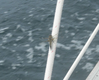
We also had another surprise visitor to the boat when we were about 20 miles offshore. We looked down at the port genoa sheet (the rope that controls the front sail) and saw, of all things, a dragonfly! It stayed with us for a few minutes, catching its breath, one would assume, then flew off toward its destination.

As the sun was setting on the 2nd night we finally saw a whale, a huge whale, only about 100 feet off our beam. We can’t be sure of it’s length, but it must have been around 50 or 60 feet long. It’s head emerged, it took a breath, and sounded. It’s back rolled on by for a long time, then its dorsal fin and finally a big tail. With a flick it was gone. We both stared at the sea where it had disappeared, hoping to see it again. Wow!
Dragonfly
Later that evening we looked over at our friend’s boat and saw a huge dorsal fin right off their bow. We didn’t know what it was but felt sure they were going to hit it. We hailed them on the radio then saw them out on deck looking down. Moments later we saw the fin behind their boat where it then disappeared under the surface. We called them again on the radio and they were all excited. A great white shark about 15 feet long had slowly swum along the length of their boat right beside them!

We also saw many seals, their heads bobbing along the surface looking much like lobster buoys, until they saw us, snorted, and disappeared. We were surprised to see so many this far out from shore, especially after the shark sighting.

Our 2nd night out was very dark as there was almost no moon and the sky was almost completely covered with clouds. We’re talking dark, here. Really, really, really dark. Sitting in the cockpit alone on night watch we kept being startled when we’d hear a “flap flap flap flap flap” sound. We finally figured out that it was shearwater taking off after being startled from their rest by Rachel’s passing. Shearwaters are a kind of gull that sleep on the surface and make a loud flapping noise with their feet as they run on the surface to get up enough speed to take off. Until we realized what it was, it was a bit nerve wracking and a bit scary, especially since we couldn’t see anything.
Who do you think won?
At any rate, in just under two days and nights and 221 nautical miles – most of it spent motoring on a glassy flat ocean interspersed with about 12 hours of easy sailing ­– we dropped anchor here at Mt. Desert Island, Maine at 9:00 am Tuesday, July 21st.
We tidied up, did our “arriving after a passage” boat jobs, went ashore for a walk in the afternoon, followed by an early dinner, a couple of quick games of backgammon, and were off to bed early. Yawn…..

03 July, 2009

New York City

Location: Manhasset Bay, NY
Position: N 40 49.913 W 73 43.014


We leave Deltaville and are on the fast track to get north. Eight days and over 370 miles later we are sailing into New York Harbor. We have travelled up the Chesapeake Bay, through the C & D Canal, down the Delaware Bay and up New Jersey’s Atlantic coast. For years Julie has been looking forward to sailing Rachel through New York City from the south as we have heard it is quite dramatic.

Entering the Hudson River we pass under the Verrazano Narrows Bridge, one of the world’s largest suspension bridges (it’s actually 20 ft. longer than the Golden Gate in San Francisco). Off in the distance, 14 miles away, we see the Manhattan skyline peeking through the haze. As we progress through the busy harbour the Manhattan skyline becomes more and more clear, then the Statue of Liberty appears as a tiny speck in the distance.

There are lots of high speed ferries and yellow and black water taxis zipping around the huge cargo ships and barges from all over the world. Although we watch the sights in awe, we also have to keep our wits about us to stay clear of all the traffic.

Staten Island is on our left and Brooklyn is on our right. The 2 knots of current against us makes for fairly slow progress, but it doesn’t matter - there is so much to see and enjoy. By the time we get close to the Battery, at the foot of Manhattan Island, we are starting to feel like a toy boat in this huge city’s bath tub. We pass right by the 300 ft tall Statue of Liberty with her gold flame glowing in the afternoon sun. Coincidentally, this is the first day she’s been open to the public since the 9/11 tragedy.

Ellis Island, through which millions of immigrants were processed into the United States, is just past Miss Liberty. The big orange Staten Island ferries zip by us every few minutes crossing from Staten Island to Manhattan. We start to pick up the city smells, dust, smog, trash, an occasional laundry and suddenly, just once, honeysuckle!!

We turn into the much narrower East River which we will follow 14 miles to Long Island Sound. Now, as we are so close to Lower Manhattan and our deck is nearly at street level, we can look up the long streets shadowed between the huge skyscrapers. There is lots of noise. Not really the hustle and bustle you would hear if you were on the streets, nothing specific, just noise – traffic on the bridges, ferry horns, tug engines, air traffic, etc. After 6 days on the water, where the only sounds are the water whooshing by and our quiet conversations, this constant noise is exhausting.

We wish our friend Carter was with us. She lives in the city and would have been a great tour guide. We are sure we’re missing a lot of famous places but it doesn’t really matter – we’re having a ball.

Now on the East river we pass under The Brooklyn Bridge. Built in 1883 it’s the first of 8 high level bridges connecting Manhattan with Brooklyn and Queens. Further along we pass lots of high rise apartment buildings on the Manhattan side and more, not as tall, apartments, and commercial and industrial buildings on the Brooklyn side. We’ve timed our passage to arrive at the infamous Hell Gate at slack tide. As you may gather from the name, this area is renowned for LOTS of current, up to 5 knots, weird eddies, standing waves, and whirlpools. It is where the East River and Harlem River meet and there’s not really any slack tide – it’s either flooding or ebbing. Our timing is perfect - we only pick up about 1.5 knots and speed the rest of the way. Between “The Brothers”, the northern island of which was used as a tuberculosis colony, past Rikers Island, the infamous New York prison island, LaGuardia airport, under 4 more bridges, out of the city and are suddenly spat out under the Throgs Neck Bridge into the serene and pastoral Long Island Sound.

We continue on into Manhasset Bay and pick up a free mooring provided by the city of Port Washington where we settle in for the night.

All day we’ve been taking turns at the helm and when Julie wasn’t driving she was sitting up on the foredeck so she could get the entire panoramic view of this great city.

Wow, what a day.


Mark & Julie
s/v Rachel

23 June, 2009

Back on the Bay

Location: Deltaville, Virginia
Position: N 37 32.845 W 076 19.778

Wow! It’s been almost a month since we returned to the Chesapeake and we haven’t even hit a lick on the Khronicles! Time to remedy that. We’ve decided we’ll finish up the one we started in the Dismal Swamp Canal and let this one be just a quick “catch up”.

So, let’s see….

We left Hospital Point, sailed up to the Mobjack Bay to the East River where we spent a couple of days visiting our friends at Zimmerman Marine and getting the 1000 hour service done on our engine.

Our next stop was Mike and Helen’s dock on the Coan River where we would leave Rachel while we visited family. We left Zimmerman’s at 9:00 am planning to travel around 30-40 miles and spend the night somewhere near Reedville, VA. That would make the next day to the Coan a short one.

As usual, however, our plans were etched in water. We somehow managed to catch an incoming tide giving us a half knot or better boost. Don’t ask us how – we’re notoriously bad at predicting currents. In fact, we decided we had a favorable current this time because we had NOT predicted it at all, not even thought about it!!

At any rate, we rode it all the way from the Mobjack up to the Coan River – including the Potomac River leg! We made it in to our friends dock just before dark having averaged 6.4 knots over the 67 nautical miles we traveled. That’s pretty good speed for us when we’re not in the Gulf Stream.

While we were tied to the dock, Mark removed Rachel’s anchor windlass (an electric winch that pulls the anchor up for us) and sent it back to the factory for some preventative maintenance. We made arrangements to borrow a car from some friends and set off to visit Julie’s daughter Charlotte and her family in Radofrd, VA.

After a wonderful 10 day visit we returned to Rachel with our grandson Alex in tow. Weather and returning the car to Richmond kept us on the dock for a day during which Alex caught his first fish, a croaker, which we threw back.

We sailed down to Deltaville, dropped the anchor, and spent the rest of the week catching up with friends, playing with Alex, and lounging around the pool at the marina. Alex’s family (including little sister Emma) came to pick him up and we all spent a night on Rachel together. It was hot and crowded, but we had fun and were sorry to see them all go the next day.


Since then we’ve been working on Rachel, getting her ready for our trip to Maine in a few weeks.

It’s time to move on. We feel like we’re growing barnacles - we’ve been anchored in Deltaville for two weeks. We’re really dug in well – a 40+ knot squall blew through here last night and we didn’t budge. When it’s time to haul anchor (probably tomorrow) the newly refurbed windlass will be given a good test. It’ll probably take an hour just to rinse the sticky black Chesapeake Bay mud off the chain!

That’s pretty much it in a nutshell. We’ll see if we can’t do a better job getting the Khronicles out once we start moving again.


24 May, 2009

Elizabeth City and the Great Dismal Swamp

Location: Hospital Point, Portsmouth, Virginia
Position: N 36 50.742 W 076 18.044


With the wind vane steering a good course on a close reach, we have a lovely, silent sail in 10-15 knots across the Albemarle Bay to the Pasquotank River and, finally, Elizabeth City.

On our way up the river we notice a huge building on the western shore. Later we look up and see a blimp hovering near the building.

Julie: “I wonder what that could be?”
Mark: “Maybe it’s a blimp factory.”
Julie: “Ha Ha. Yeah, right.”


Elizabeth City provides 14 free slips and a couple of bulkheads to which visiting boaters can tie up for two nights. If there are more than 4 new arrivals, the “Rose Buddies” put on a free wine and cheese reception! This has been going on for over 25 years – what a nice town!

We pick a slip, tie up, and go for a nice, long walk through the commercial district and the nearby old neighborhoods. Four more boats arrive, so at 4:30 we meander over to the Rose Buddies reception. There, we learn that the big building we went past earlier is, indeed, a blimp factory! All the blimps in America (except the Goodyear blimps) are made here!

We visit with the other boaters who have arrived then head back to the boat. When we get there, a voice message tells us Mark’s brother and sister in law are on their way to see us. We have a nice couple of days visiting with them, checking out the blimp factory, going for a sail, getting stopped by the Coast Guard for our first ever boarding (a random safety check – we passed), and catching up with each other – we haven’t seen each other since Mark’s dad’s funeral last fall.

Saturday morning we get up and walk about 50 few feet to the farmer’s market at the park behind the free slips. We buy four tomatoes, a bag of green beans, some zucchini, and some yellow squash – all for $4.00 – a good deal on some great vegetables. We say our goodbyes and head up the Pasquotank River toward the Great Dismal Swamp Canal.

The Pasquotank River above Elizabeth City meanders and narrows but retains plenty of depth. We pass logs covered with turtles, spot lots of different birds and trees, and watch the swampy bits slide past. Surprisingly there are no bugs. The shore closes in on us and soon we’re negotiating the turns with only 20-30 feet between us and the log and stump strewn banks on either side.

We reach the lock up to the canal a few minutes after it closes so have to wait a couple of hours for the next locking. We drop the anchor on a short rode, sit back, and relax. That’s when we see it – a huge mottled snake thicker than Mark’s arm lying on a stump sticking out of the water only about 20’ from the boat. Another boat arrives and we point it out – the captain says “That’s a cottonmouth.” Wow. Poisonous!!!

The lock opens and we enter and loop our lines around the bollards. The water begins to rise and we’re lifted about 8-10’ up, taking up the slack in our lines as Rachel rises to the level of the canal. The lock opens and we’re presented with a 100’ wide arrow straight strip of water. We pass a small town and tie up for the night at the Dismal Swamp Visitors Center – the only visitor center in North Carolina that services both auto and boat traffic. We have a nice short walk around the immediate grounds, then retire to Rachel for dinner and a quiet night.

In the morning we go for a longer walk on the board walk through the swamp, a winding trail through the woods, and along a dirt road that parallels the canal. It’s beautiful here, but we’re ready to get going again. At about 9:30 we release the lines and have a nice leisurely run up to the next lock.

As we’re locking through, dropping 12’ or so, the lock keeper walks by and spots Mark’s conch horn. He asks Mark to play it for him, then disappears for a second. He reappears with a colorful painted conch and proceeds to give Mark a series of lessons guaranteed to make him a better, more versatile conch player. “Conch Horn Bill” has a well deserved reputation for being one of the best conch horn players around, and Mark appreciates being “schooled”.

A few more hours and we’re anchored at Hospital Point on the Elizabeth River, Mile 0 of the Intracoastal Waterway with only another hour or two to go until we’re on the Chesapeake Bay.

11 May, 2009

Cape Lookout

Location: Cape Lookout, North Carolina
Position: N 34 37.825 W 076 32.401

After heading up the Cape Fear River and spending a lovely day with family in Wrightsville Beach we headed offshore on Mothers Day for a lovely sail up to Cape Lookout. We had heard from friends that it was a wonderful spot to anchor and wind down - they were absolutely correct. Cape Lookout is a National Seashore protected by the National Park Service. As you would imagine, it has pristine beaches and is totally undeveloped except for the old lighthouse and coast guard station and associated buildings.

The cape and its associated shoals are one of the most treacherous stretches of the eastern shore for passing ships. The coast of North Carolina between Cape Lookout and Cape Hatteras is known as “the graveyard of the Atlantic”. Because the land was so low a ship could be aground before realizing it so a lighthouse and a coast guard station were built there in 1812.

Behind the outer cape and its shoals is a large, deep bight of water teaming with loggerhead turtles. We spent our first night at the northern shore against Shackleford Banks, an island that is home to over 100 wild horses. As we dropped the anchor we could see some of them cantering along the beach. The next morning we dinghied ashore and enjoyed a long walk along the beach accompanied by a herd of 10 or so horses. We really needed the exercise after sitting on the boat for so many days!

Later we took Rachel to the south shore and anchored in 25 feet of water. The afternoon was spent in the cockpit reading and watching the loggerhead turtles swimming around us.

The next morning we set off fairly early and had another really long walk along the beach, through the now closed Coast Guard station and along to the lighthouse. The lighthouse is not open to the public but we looked around the lightkeepers house and its associated buildings then walked all the way back along the beach. We felt like our walking muscles were finally starting to get back into working order!

We moved on to Beaufort the next day but we definitely want to come back and spend more time here, Cape Lookout has earned a place on our list of favourite stops.

Mark & Julie
s/v Rachel

07 May, 2009

Landfall

Location: Southport, North Carolina
Position: N 33 55.039 W 078 01.690

With the Family Island Regatta finished we were on the fast track to get back to the US. After a couple of days waiting out high winds and seas we set sail with our new friends on Osprey and Magic. Our first day was a rolly ride up the Exuma chain. In the morning we caught another mahi in the deep water, so another wonderful dinner of grilled mahi-mahi was assured. Around noon we passed through Cave Cay Cut onto the banks side and the seas flattened out for the rest of the day. It was a long day but good sailing. We topped off our fuel and anchored off Sampson Cay for the night.

A fairly short hop the next day to Normans Cay gave us the opportunity for an afternoon ashore. Every chance for a walk and a swim is precious now as we won’t be able to enjoy this azure blue water much longer. Normans Cay has a bit of a nefarious history due to Carlos Lehder’s cocaine smuggling operation based there in the late 1970s and early 80s. (http://en.wikipedia.org/wiki/Carlos_Lehder).

The next day was another long downwind run up to Nassau – we all got out our spinnakers (those really colourful big downwind sails). It was a great sailing day. We anchored about 5 miles from Nassau at Rose Island, a very picturesque spot and had our final snorkel and swim of the season. Looking in one direction we could see the skyline of Nassau with it’s tall buildings and cruise ships, and in the other direction we saw white sand, coral reefs and desert islands reminiscent of Gilligan’s Island. We had a bit of a rolly night in the anchorage and none of us slept that well, probably due to anticipation of the 600 mile trip we were embarking on the next morning.

We like to do 3 hour watches on a passage and Osprey and Magic prefer 2 hour watches. We decided we would stay in contact on a single, nearly unused channel on the VHF radio. Because of our alternating watch schedule we had revolving people to chat with during our trip, making the passage back a bit more interesting than usual.

We weighed anchor 06:00 and the wind was dead behind us. This isn’t a great direction for Rachel since we broke our whisker pole (but that’s another story…) – so we ended up motorsailing more than we’d like. This was to be the case for most of the trip back. Every time we changed course to head further west, then north, then east, the wind changed direction and followed us, remaining dead behind.

At around 04:00 on the second day we were approaching Freeport on Grand Bahama Island, the other major city and port in the Bahamas. No chance of falling asleep on watch here as there were too many ships and lights to watch out for. A bit nerve racking but with all 3 boats watching out and chatting on the VHF we managed to pass by with no problems.

We now started to head NW and into the Gulf Stream – here’s where we’d make tracks, picking up a 3-4 knot boost in speed. It took us longer than we expected to reach the maximum flow, but eventually we were honking along at times making 11.4 knots over the ground (that’s really fast for us we usually do well to make 6.5) Once we hit ‘the Stream’ we headed North and now it was just a matter of riding it as far as we could. Of course the wind changed again, remaining behind us, and we continued to battle to keep the sails inflated in the rolly seas. Rolly is fine if all, you have to do is sit in the cockpit and look pretty but when you are needing to wash, sleep, prepare food, do the dishes, and use the toilet it’s not all that much fun!!

Every day we checked the weather and on the evening of day 2 the report was for the winds to shift to the north and pick up in a couple of days. At that point we decided we’d head for Charleston, about 100 miles short of Beaufort, our preferred landfall. We started to work our way out of the Gulf Stream. The next morning, as we were approaching Charleston, the weather mavens decided that the deterioration of the weather had slowed down so now it looked like we would have another day of decent weather. At the last minute we changed plans and direction and headed another 70 miles up the coast to Southport. For the last few hours in the early morning on day 4 we had to slow down to 4 knots or less so that we would not arrive before dawn. It’s definitely not much fun making landfall in the dark!! So at 06:00, 4 days and 4 nights and 630 miles after leaving the Bahamas, we were negotiating the Southport entrance channel.

Around noon the heavens opened and we had a huge thunderstorm and wind shift. Boy, were we glad we were in a safe harbour. We timed the weather just right!!

It’s hard to believe that just 8 days ago we were in George Town.