25 December, 2007
Merry Christmas!!
Position: N27 39.567 W080 22.290
Christmas is finally here.
It’s easy get out of touch with what's going on in the world living on a boat when it's just the two of you and the VHF radio. We've been exchanging Christmas wishes with the few bridge tenders we contact via VHF and the few boats with which we've had conversations over the past week. We finally stopped moving last Sunday and have been enjoying being in one place for the past couple of days. Yesterday we finished up our last-minute Christmas shopping. We were a bit hesitant about shopping on Christmas Eve, something we usually try hard to avoid. It turned out to be a nice day, however. We were pleasantly surprised while out and about; no apparent greed, no rush to the register, no impatient huffing in line - everyone we saw on the bus and at all the stores was smiling and wishing everyone else a Merry Christmas. We picked up some decorations for our mast "tree" - even the treetop ‘angelmoose’ has baubles hanging from his antlers. Now that we have a ‘tree’ with gifts under it, we’re finally home for the holidays. (Check out the blog for pictures)
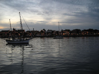
Last night a boat that was decorated like Santa's sleigh w/ Santa and a team of reindeer in harness all made of lights cruised through the anchorage. You could almost not see the boat - it really looked like Santa was doing a slow pass. Mark hailed them on the VHF: "Santa, Santa, Santa, this is Rachel" to which was replied "This is Santa, Rachel. Ho Ho Ho! Merry Christmas!"
This is our first Christmas in years without immediate family. We miss sharing it with our kids, especially the last few years with Charlotte, Kelly, Alex, and now, Emma. We miss the preparations, the sleigh bells ringing outside Alex’s window to remind him Santa won’t come until he’s asleep, the lazy breakfast, making the gift opening last into the afternoon. The mooring field here at Vero Beach is pretty crowded - there are two and three boats on almost every mooring. We are rafted up to a boat that has a family with two children aboard - Brandon is 6 and Phoebe is 3. We awoke this morning to the sound of their excited voices and laughter through the forward hatch above our berth. It brought a happy / sad tear to the eye.
Now it's raining and still, and the anchorage is awash with smells of baking ham and turkey and who-knows-what-other wonderful dishes as our neighbors all around prepare their Christmas dinners. We've been invited, along with some other cruisers, to dinner with Rachel's previous owners, our appetite's are already growing and we're looking forward to a wonderful afternoon.
Rachel's crew would like to wish all of you a very Merry Christmas and a safe and happy New Year.
Peace,
23 December, 2007
Careening Towards Christmas!!
Position: N27 39.567 W080 22.290
We have heard that if you want to be in a warm climate don’t stop heading south until you get to Vero Beach. Well, we ARE here and it IS warm.
We left St Augustine on Friday morning.
There’s a kind of stone used in building the fort in St. Augustine and other old buildings in the area. It’s called coquina and is formed from compressed oyster shells and coral. Every morning as we raise the anchor we see the beginnings of this lovely rock, big clumps of mud surrounding shell pieces. At least it’s not smelly like the Chesapeake mud!
We once again planned to head out into the ocean and take a quick overnight hop down - we were all prepped and ready. We got up at 6am after a windy night in the anchorage and, not-so-surprisingly-anymore, the weather forecast had changed. High winds, high seas, thunderstorms, gusts to gale force, etc. Crikey!!
We have been in touch off and on with Rachel’s previous owners who are currently house sitting in Fort Pierce. They called to see what we were planning for Christmas and asked “Why don’t you come down here for Christmas?” This sounded like a great idea, so, instead of waiting for the weather to clear, we decided to “hit the road” figuring we could make the trip down the ICW in 3 long days and still have the option to pop outside to save time if the weather improved.
Day 1 - St. Augustine to Daytona Beach – N29 12.55 W081 00.455
It was really windy all day, but behind us most of the way, which is good, and sunny with lovely scenery. The wind was supposed to die down in the afternoon – not. We went past Daytona Beach, but had trouble finding a good anchorage with the depth we need, so we backtracked a bit and anchored right in town in the lee of the Memorial Bridge. We figured that when the weather cleared overnight we could duck outside at the Ponce De Leon inlet in the morning and make the rest of the trip pretty quickly. Needless to say the wind did not die down as predicted - all night long it howled and was now and again accompanied by pounding rain. Two or three times during the night we had to get up and adjust the anchor snubber. Needless to say, neither of us slept very well.
Day 2 - Daytona Beach to Cocoa – N28 20.986 W080 43.186
After our second semi-sleepless night we awoke to continued high winds and drizzle. We’re not sure why we even bother listening to the weather forecasts these days!! No going outside again today. We raised anchor at 7:15am and headed out. The good news - it is not cold, so although we are wet, at least we are not cold and wet!!
TowBoatUS are the friendly guys all down the coast who tow people off sand banks when they run aground. They seem quite happy to tell you about trouble spots and the best way to negotiate them. This fund of local knowledge is only a phone or VHF call away, but most folks don’t seem to take advantage of it. The Ponce De Leon inlet just south of Daytona has developed a reputation lately for being a bit tricky so Julie called to get the latest info. We were glad we did as the visibility was pretty bad and some of the navigation marks had been moved because of shoaling.
It actually ended up being pretty straightforward. Apparently lots of boats run aground here (three just yesterday!!), but it seems to us that it’s those captains who trust their chart plotters more than their eyes and the marks who are the ones keeping the good folks at TowBoatUS in business! We’re also glad we decided not to try and negotiate the inlet to the outside – about 30 minutes after we passed it on the ICW we heard an announcement from the Coast Guard that 4 buoys were out of position or adrift! That could have proven a bit problematic…
The rest of the day was pretty uneventful. After passing the inlet just after high tide, we got a huge boost from the falling tide for a couple of hours going down through Mosquito Sound. By late morning the rain had stopped and by lunchtime the sun was out. It was still pretty windy but we did manage to get out of our rain gear and hang it on the life lines to dry. We passed by Cape Canaveral, the shuttle launching base, which is surrounded by Merritt Island Wildlife Preserve. It’s a win-win situation as the base gets a wide open buffer around their launch facility, which is not used that often, and the public get a huge natural ocean front area to enjoy. We finally dropped the anchor at Cocoa as the sun was going down 5pm. We ended up making our longest run to date on the ICW - 67 statute miles - on the shortest day of the year.
Day 3 - Cocoa to Vero Beach N27 39.567 W080 22.290
We finally got a good night’s sleep. The wind died down and there was not much current on Indian River – it was like a mill pond (“What is a mill pond like anyway?”). A slight drizzle fell as we raised the anchor at 7:30 but soon it cleared and we had cloud cover most of the morning followed by a sunny and warm afternoon. Folks call this part of the trip boring. For us, however, it was relaxing – no shallow bits, no shoaling inlets, no tricky currents, not much tide, lots of marks – it’s like driving down a highway. After having to time our transits and be pretty vigilant most of the time through South Carolina, Georgia, and northern Florida, it was actually a bit refreshing.
Not too bored and looking forward to Christmas Eve tomorrow (Note from Julie – also our wedding anniversary Hint Hint!!),
20 December, 2007
America’s oldest city
17 December, 2007
The Belles of St Marys
Position: N30 43.174 W081 32.845
We just spent two lovely days in the old town of St Marys, Georgia (http://www.stmaryswelcome.com). What a delightful town. The historic waterfront downtown area is quite old. Just across the river is Florida – we’re almost there.
We began collecting “belles” here. Our first was a lady handing out clues for a scavenger hunt - kids were looking for a Yule log worth $100! She had the “most chahmin’” Georgia accent; we could have listened to her all day. We chatted with her for a few minutes – she was very helpful and friendly.
Our next three “belles” had stalls at the local farmers market. There was no grocery store close to downtown so we eagerly reprovisioned from the few stalls. Following more chit-chat, we bought local squash and a pomelo ( a huge citrus fruit, we’ve never tried before ), fresh shrimp, and some local honey.
Some of the townspeople had organized a fun Christmas celebration in the riverside park which was scheduled for our first afternoon and evening. Everything was free: visits with Santa, games with prizes, food and drinks, art projects, a balloon clown, and in the evening a movie. The stage was decorated and we enjoyed local groups, a children’s hand bell choir, and choirs from small children to old folk. It was all organized by volunteers and supported by donations from local people and businesses.
We got to chatting with our fifth belle, a 75 year old lady, Marsha, who sang with the community singers named ‘Cumberland Sound’, a clever name which links the singers with the body of water we had just crossed. We asked her if there were any other Christmas programs in town and she said “Why would you want to go hear anyone else? We’re the best.” So, of course, we stuck around to hear them sing. They were, indeed, very good.
Later in the day as we were walking back to Rachel, a Jaguar pulled up next to us. Marsha jumped out and asked “Do you want a tour of the town?” So in we bundled and she drove and chatted around the whole area, including the nearby nuclear submarine base where she works part-time. She said if we ever stop back by we should bring our drivers licenses and she’ll arrange a tour of a submarine for us!!
After we’d eaten dinner we decided to go for another walk around town to look at the Christmas lights. As we passed the park the locals were taking down the decorations from the afternoon so we stopped and helped. It was the least we could do after enjoying the festivities. We made friends with the Santa and his wife (our sixth belle) named Sydney and Rindy (say that 10 times fast!). We spent a companionable evening in the park chatting together about St. Mary’s (Sydney grew up there), kids (we all have our war stories), and solving the problems of today’s society.
Day two was mainly spent just wandering around, doing laundry and taking it easy. We collected our seventh belle in the Visitors Center (another hour or so chat session) followed by a visit on Rachel from Rindy and Sydney. They brought us a couple of bags of fresh cumquats from their tree ‘out back’. They’d never been on a sailboat before and really seemed to enjoy seeing how we live.
We were very impressed by the strong sense of community at St. Mary’s. As we wandered the park we chatted with kids and their parents – we were met with none of the suspicion of strangers that seems so common these days. Volunteers in town have also organized a “Wounded Warrior’s Day” parade that takes place the day before Veterans Day “because there wasn’t a special day to honor all who have been wounded in defense of our country”. They also started a “Cruisers Thanksgiving” feast, turkey, ham etc provided free, cruisers just bring a side dish to share. It started out with about 10 visitors a few years ago, and has grown to 300 this last Thanksgiving. There are many other examples of how this small community has worked very hard to create and maintain its small town feel, and we are very appreciative of their efforts. It really warmed us and helped bring out more of the Christmas spirit in us both.
Wishing you all a small town Christmas,
Mark & Julie
s/v Rachel
15 December, 2007
Cumberland Island
Position: N30 51.571 W081 28.055
In the process of dropping the anchor, Julie tried to remove another finger using the electric anchor windlass, but got off with some bruising and a couple of cuts (Captain’s note – yeah, right - see if she gets to try dropping the anchor again!) (Navigator’s note –
That little potential disaster averted, we iced her hand, put on some Band-Aids, lowered the dinghy, and went ashore for a walk. This is a really beautiful island. It was privately owned until the 1970s when it was given to the National Park Service (http://www.nps.gov/cuis). The nation’s first black Baptist church is preserved here. It was a summer home to the Carnegie clan. It barely escaped being developed like all the rest of the barrier islands on the East coast and we (among many, many others, we’re sure,) are really thankful it did.
We went ashore at a dock we’d read about – it’s labeled “authorized craft only”, but the fellow who wrote one of our cruising guides called the park service and learned that it’s okay for visiting cruisers to tie up for a few hours. We didn’t see a soul. Other than some wild horses on the shore near us, we were alone. We dropped our $8 into the honor-system payment drop box. By this time we’d been on the boat for several days and a nice long walk sounded really good to us. We found a trail that led to the other (seaward) side of the island and started off.
The path was lined with gorgeous huge live oaks w/ Spanish moss dripping off them. Sunlight filtered through it all, and there was silence except for a low rumble we’d been assuming was industry of one sort or another from the submarine base across the
The path was bordered by lots of saw palmetto. When you brush up against the leaves, they rattle pretty loudly. There are a lot of leaves on the forest floor, as well, but the path was mostly sandy w/ a light covering of long leaf pine needles and live oak acorns. We’d hear a rustle in the underbrush as we walked and look to see what wildlife we could see.
As we got closer to the other side, the “industry” sound we’d been hearing became louder – about then we realized it was the surf on the beach. Doh! A brief interlude of swamp on either side of the path, a sandy hill to clamber over, a bit more in the woods, a pile of bricks (the remains of the Duck House?) and we came to the dunes.
Spectacular. We scrambled up the back side and finally caught sight of the sea. We were met with a vision - a beautiful white sand beach and not a soul to be seen, not a structure, no trash, and, other than some footprints and old tire tracks along the beach, no sign of man as far as the eye could see in either direction. We can understand why the island’s owners were willing to gift their home to the National Park Service rather than see it developed.
Wishing you a bit of this solitude and quiet,
s/v Rachel
14 December, 2007
Simple Pleasures
Position: N30 53.25 W081 27.336
We finally had a good day’s run yesterday and got through the last three “Georgia problem stretches” without incident. We’re now at anchor at Cumberland Island, a national park, at the south end of Georgia. We had made reservations to stay in St Augustine, FL Sat-Mon but decided to postpone so we could spend a couple of days here, do some walking, relaxing, and wait out some weather.
We’d been thinking that the Khronicles have focused a lot on our experience of getting down the Waterway. In retrospect, we feel that we haven’t really shared some of the simple day to day pleasures that we enjoy. Here’s a random list of a few things that come to mind:
We haven’t mentioned dolphins lately, but we are certainly not getting blasé about them. Nearly every day we see dolphins and they are still spectacular, and give us so much joy. They seem to be watching for us, too. We will see a fin or two up ahead and note that they’re making their way toward us. Whoever is not at the helm will go running forward and stand on the bowsprit. Looking down, you can see the dolphins swimming right below you, just under the surface, right at the bow of the boat. It’s like they are trying to race. They will bop from one side to the other and then peel off or down and swim away. They’re always beautiful and graceful and we never tire of watching them.
Sitting in the cockpit with the binoculars looking into the marsh grasses and the waters edge, we’ve seen terns, pelicans, egrets, cranes, loons, merganzers loads of waterfowl, etc. The outside world seems so far from here at times. Most of the time there are few man-made noises so we’ll just sit and listen to the wildlife and look at what’s going on around us. Julie is still waiting to see her first alligator!!
Pelicans are abundant and the way they fly around and then plummet into the water upside-down to catch a fish never ceases to amuse us. A crabber in a small powerboat zoomed by Rachel one morning. There was a little surface mist on the water and a string of about 15 huge pelicans were flying behind him, gliding just inches above the surface of the water. How can they be so goofy and yet so graceful in flight?
Looking out over the grasses we saw the top of Sapelo Island lighthouse just peeking out wanting to be seen.
Enjoying being with each other: laughing at silly sights, names, thoughts; quietly watching the sun come up, or go down; sharing the writing of these Khronicles; planning our travel days, and continuing to work our way southward.
Peace,
12 December, 2007
Georgia on my mind
Position: N31 23.999 W081 21.383
We have spent the last three days eeking our way through Georgia. The days have been very much the same – dense fog in the morning, absolutely gorgeous, clear, and warm, (albeit mirror still) in the afternoon and early evening. Combined with the fact that high tide has been in the morning during the fog, we’ve had a series of frustratingly short days. We thought a brief lapse into “reality TV” might be relevant. The following are a few, pretty typical snippets of conversation between Captain and Navigator aboard s/v Rachel for:
Monday, 10th Dec , Wright River to Vernon River – finally make it to Georgia
N31 56.072 W081 06.993, 24 nautical miles
Tuesday, 11th Dec, Vernon River to Wahoo River
N31 35.973 W081 12.6, 31.4 nautical miles
Wednesday, 12th Dec, Wahoo River to Darien River
N31 23.999 W081 21.383, 21.8 nautical miles
“7:00 AM! Time to get up!”
“But it’s thick fog outside!”
“OK, but as soon as it clears we’re out of here, so be ready.”
“Umph.”
1 hour later…….
“Okay. Quick the fog is clearing.”
“Is not! Those shrimp boats anchored down river still aren’t visible”
“Oh come on.”
Later ….
“It’s getting better … oh…wait … no it’s getting worse.”
Another hour later……
“Okay, it looks like it really is time now, go haul the anchor.”
“But the high tide is already past - it will be too shallow now at Hell Gate”
‘Aw, geez. The water’s probably still high enough. Come on. Let’s give it a try.”
As we enter any problem area, we hail other boats we see ahead of us and ask them to let us know if they see any shallow water (this is one of the ways we make friends on the ICW – sad, but true…). If we are told there’s no problem, we continue through.
Later….
“That wasn’t so bad. At least we didn’t bounce in the mud like we did yesterday at low tide.”
“Yeah. Phew!!”
“The good part is now we have a nice easy passage through St. Catherine’s Sound, so we can relax and finally shake out the sails!”
“Yeah, woohoo!……. Uh…wait a sec….where did that shrimp boat go? Where’s that next mark? Oh no, more fog!”
Navigator is at the helm, moments of hilarity ensue as captain runs below, turns on the radar, roots through the lockers, finds the manual air horn, runs back to the cockpit, pumps it up, runs to the bow, honks the horn for 5 seconds, listens for a bit, runs back aft, pumps it up again, makes a ‘securite’ (pronounced “secur-i-tay”) call on the VHF to alert any nearby vessels that we’re proceeding south under limited visibility, and runs back forward to honk the horn again within the requisite two minutes. Pump pump pump – honk, listen, pump pump pump – honk, listen. Navigator, between snickering at this hilarious sight and offering “helpful” suggestions, stays on GPS course, checks the radar, checks the chart, and keeps a look out. Luckily we don’t hear any other horns or see any questionable “blips” on the radar.
This continues for 30 or so minutes then the fog finally clears.
“Phew, thank God that’s over.”
Later, after Johnson Creek……..
“If we hadn’t been so late leaving this morning the water would have been much deeper.”
“Phew. I’m looking forward to a nice relaxing evening.”
“Uh, the chart says 35-45 feet and the sounder says 8.5 feet.”
“What the ….? Look! You can see the marks! Check the GPS! We’re right on top of the deep bit! What the heck is going on?”
“Which way should we go?”
“Heck if I know. Try heading a bit to port.”
“Sheesh. Okay. That’s better. At least we can finally relax NOW while we cross Sapelo Sound. Let’s get the sails out!”
“Uh, not quite yet, if we keep going we’ll get to Creighton Narrows at dead low tide.”
“Yeah, but I bet we can get through there, too. Let’s go for it.”
It looks a bit white over that way and we hear several boats ahead of us make securite calls on the VHF - “we’re on Sapelo Sound running under zero visibility.”
“Oh. Crap. I guess that decision’s been made for us.”
“Let me check the charts….. looks like our best bet is to head up to the Wahoo River and anchor for the night.”
“Sounds good. I’m pretty much tired of fog and shallow water, anyway.”
Later after negotiating more uncharted shoals, anchor dropped, and dinner started, we turn on the weather: “Dense fog alert from early evening through tomorrow morning around 10:00.”
“Aw, jeez. Another day like today! Where’s the gin?”
Sigh……
10 December, 2007
All dressed up and nowhere to go
Position: N 32 04.304 W 080 55.074
We wake up Sunday morning, put on the coffee, and get ready to leave Beaufort. We turn on the VHF radio and are met with a “dense fog advisory” for the entire coast that continues into the afternoon, along with a warning in an actual human voice to stay in port if possible. It seems that fog allowing “at times zero visibility” is rolling in off the ocean this morning and is working its way inland. We remember that every cloud has a silver lining and decide it’ll be fun to go back to town for the on-land Christmas Parade in the afternoon.
We spend a leisurely morning on Rachel waiting for the fog. La-la-la no fog. Finally at 11 am we decide there isn’t going to be any fog. Julie wants to get going! We have weighed the pros and cons of “going outside” (out into the Atlantic) to bypass the shallow Georgia section of the waterway. Even though we really want to go outside for our next leg (and do some sailing, for goodness sake!), the coastal fog advisories out as far as 20 miles for the next few days help us decide to stay on the ICW. We certainly don’t want to get stuck in fog on the ocean if we don’t have to. Besides, friends have told us some of the prettiest sections of the waterway are along this route; here comes that whole ‘silver lining’ thing again.
The day is warm and sunny and we have an uneventful trip almost into Georgia. We pass only one tricky shallow spot without mishap and finally drop anchor in the Wright River, just off the New River, coincidentally the same name as the river back home in Radford, though no relation, we’re sure. For the next hundred miles or so we’ll be busy negotiating some of the shallowest spots on the ICW. The high tides getting later in the mornings will be very helpful, as long as we don’t get fogged in.
....so here it is, Monday morning. And the fog has really rolled in. We sit at anchor impatiently popping our heads up every 5 minutes, waiting for the fog to dissipate so we can get on our way through the next tricky bit before the tide is too low for us to make the attempt.
Feeling all dressed up with nowhere to go,
09 December, 2007
Byu-fert
Position: N32 25.195 W080 39.350
We raise anchor and leave Tom Point Creek on Friday, December 7th, a chilly and cloudy morning. Our ‘friends’ at NOAA weather tell us it’s going to get up into the mid-sixties this afternoon, but it’s wooly jumpers, caps and gloves, and foul weather gear this morning.
We work our way down the waterway, dodging shoals and making pretty good time. We decide to give the Ashepoo-Coosaw Cutoff (we love the names down here) a miss due to its reputation for a large and growing shoal at it’s lower end. Low tide today is around noon there, and that’s about when we would be transiting. Instead, we follow the Ashepoo River to its mouth in the St. Helena Sound and work our way back up the Coosaw River to rejoin the ICW. In the sound we find a shrimp boat named ‘Hustler’ with his nets out looking much like a cormorant drying it’s wings. Julie calls him on the radio to ask how he’d like us to pass and, after a brief, pleasant exchange we gradually pass in front and leave him in our wake.
The other reason we take the St. Helena Sound is so that we can actually have some room for a sail today. Rachel IS a sailboat after all, and it’s been ages since we’ve been able to sail. No such luck – there was absolutely no wind and we again spent the day motoring.
We arrive in Beaufort in mid afternoon and drop anchor. The sun is out and it’s time to get out our shorts and tee shirts! In North Carolina, Beaufort is pronounced “Bow-fort”. In South Carolina, it’s pronounced “Byu-fert”. They’re both named after the Duke of Beaufort and no-one seems to know why they’re pronounced differently.
Beaufort is a friendly town. We call up Lady’s Island Marina to see if they have a dinghy dock we can use and are offered its use for free. We dinghy over and walk about a half mile up to the Publix supermarket for provisions. We are packing our bags and our little folding crate cart ready for the walk back. A friendly woman walks up and asks if we’re on a boat. We say yes and she proceeds to give us a ride back to the marina dock in her car!
On Saturday morning we do laundry and visit the hardware store. A sign on the Laundromat window intrigues us: “No loitering or no drinking”. We wonder if this means you can drink if you’re not loitering and loiter if you’re not drinking. We leave not knowing, but we did neither, just in case!
Around mid-day we dinghy over to the free town dock across the river, right in historic downtown. A walk around the old part of town, followed by lunch at one of the eateries along the waterfront are in order. As we’re eating we overhear the waitress telling a woman at the next table about the boat Christmas parade scheduled for this evening! We get the details and decide this is a must, since it will be the third floating Christmas parade we’ve seen in three weeks – Little River, Charleston, and Beaufort. We’re definitely on a roll! We return as the sun is setting and tie up again at the town dock for front row seats. Armed with appetizers and a glass of wine the very creative “floats” made for a lovely evening. A night-time dinghy ride back to Rachel and we’re done for the evening.
Bobbing in Byufert,
05 December, 2007
Brrr
Position: N32 38.987 W080 17.730
We left Charleston a little before noon yesterday. What with timing the tides for the currents and shallow bits, we only made just over 20 nautical miles. We dropped anchor at about 3:00pm in a lovely spot, Tom Point Creek off the Wadmalaw River. We were looking for a protected spot as the wind was supposed to pick up and be pretty gusty today.
Many times finding a protected spot is not too easy on the ICW; in some areas anchorages can be pretty exposed – fine if the weather is settled, but not somewhere you’d like hang out with the forecast calling for gusts to 30 mph. We chose carefully, however, and this anchorage is perfect. It’s a winding creek with trees on either side, offering great protection from the wind.
We spent the better part of the day doing a few little jobs. Then we took a dinghy ride up the creek where we saw dolphins, cranes, hawks and osprey. We also went and visited another sailboat that followed us in here yesterday and met a lovely couple who are also heading south. They’re in a steel boat they built themselves in just under 8 years - talk about a labour of love!
Last night got a bit chilly, dipping into the 30s. Tonight’s low is also expected to get into the 30s and the high tomorrow is only supposed to get up to the low 50s – that’s pretty chilly in an exposed cockpit in the wind. To keep it in perspective, though, we try not to feel too badly as it’s apparently snowing in Blacksburg today. So we’re pretty sure that we won’t get much pity for our chilly night from the folks back home. The up side, however, is that after tomorrow we’re expecting light winds and temperatures in the 70s at least through the weekend. Ahhh…
Still heading south
03 December, 2007
Charleston, SC
Location: Charleston, SC
Position: N32 46.5 W079 56.9
Charleston is … well … Charleston. What a nice city! We really like it here and are looking forward to stopping by again with more free time available.
We arrived at the City Marina dock at around noon on November 30th. Our exhaust riser wasn’t here yet, but our friends from Blacksburg, en route to the Virginia Tech / Boston College ACC championship football game in Jacksonville, FL, were. They spent the night with us on Rachel, went to the game on Saturday, then came back and spent the night with us again on their way home. It was great to see them and, as always, we all had a good time, even though it was a short visit.
Our riser came later on Friday afternoon. Mark installed it, but wasn’t happy with the fit. It needed a couple of modifications and we weren’t too thrilled at the idea of sending it back to the place that originally made it for us – a “seven working day turnaround” for the original had turned into almost a month by the time it arrived.
We found a local guy (who was willing to work on Sunday!!) who got us all fixed up. It took Mark most of Monday to get it installed to his satisfaction, so an overnight stay turned into 4 nights at City Marina.
We don’t usually give recommendations in our Khronicles, but Brad was especially easy to work with, did a great job, and was reasonably priced. If you ever need stainless or aluminum welding work done in Charleston, call him at 843-343-1721. His company is named “Charleston Top and Tower”.
Okay, back to Charleston. We really enjoyed wandering through the old neighborhoods looking at the wonderful architecture, gardens, and cobblestone streets. We took side trips down alleys and discovered little cottages and gardens that one couldn’t see from the street. The weather has been great allowing us to wear short sleeves and shorts during the day. We could have spent several more days, at least, wandering around the backstreets and sampling some of the many fine bars and eateries. Unfortunately it is starting to get cold again - time to start heading further south.