Position: N15 51.400 W 088 33.406
We leave the island of Utila and begin to head further west. Our ultimate near-term goal is to is to arrive at Livingston, Guatemala by April 27th.
This date is significant to us because the high tide there at 7:00 am is 1.84' higher than mean low water. Rachel draws 6' and the entrance to the Rio Dulce is blocked by a wide sand bar that's 5' deep at mean low water. By waiting until the 27th, we should see 0.84' under our keel as we approach Livingston to clear in to Guatemala.
The fact that the high tide occurs during the morning is an added plus for us. Livingston has a terrible reputation for theft and boardings – everyone's advice is to clear in and get the heck out, heading up river to spend the night at one of the “safe” anchorages further up stream. Needless to say, this got our attention and we decide that the 27th fits our plans to a “T”.
 Rachel in Puerto Escondido |
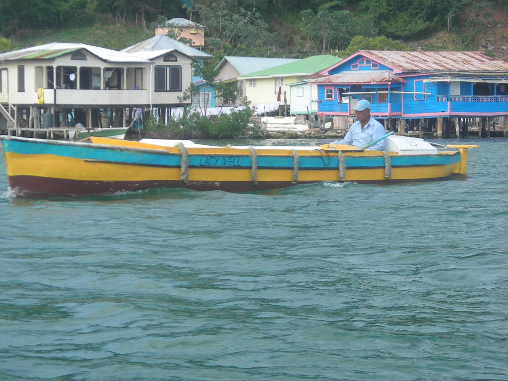
Our first scheduled stop along the coast of Honduras is Puerto Escondido. We sail across the Bay of Honduras to Punta Sal and head south along the mountainous and rocky shore. As we approach, the anchorage opens to us and we see a beautiful beach surrounded by mountains and jungle. There are no other boats here, so we pick our spot, drop the anchor, and relax (position N 15 54.544 W 087 37.908 W). This little harbor lies within the bounds of the “Parque Nacional Jeanette Kawas”, a 782 sq. km. National park - and it's a total gem.
We see a couple of locals walking the beach with a dog. The dog runs into the woods and we hear what sounds a bit like a bunch of other dogs barking at it. We finally realize that the “barking” we're hearing is the resident howler monkeys hollering at the dog! We eat dinner in the cockpit listening to the varied sounds of the jungle and the howler monkeys. It's amazing and a little spooky. And we love it.
 |
Today is our 3rd year anniversary living aboard Rachel and cruising. We couldn't ask for a more perfect location for this milestone occasion.
 |
The cruising guide says that there are trails in the park so we get ready to head in to shore for a hike. Julie looks over and sees a group of people on the beach. “Hurry” she says to Mark “we can ask that group about the trails”.
On our arrival at the beach we discover it's a group of Americans! They are in Honduras with a church group from Mystic, CT. The church built a school a few miles inland 20 years ago and each year a group comes down to add a new building or do upgrades and repairs. Today is their last day and they traveled here with a couple of guides for a day off before returning to the US.
 |
 |
It's hard to tear ourselves away, but on Saturday morning we haul anchor and head for our next stop – Omoa. The anchorage at Omoa is protected from the south and east, but is exposed from every other direction. The wind is supposed to be light and from the SE, so we feel pretty good about being here.
That is until the “music” starts. Bump ba dump. Bump ba dump. Bump ba dump. Poor Rachel is shivering her timbers. We're being thrown about the cabin. Bump ba dump. Bump ba dump. Our brains turn to jelly. How can anyone possibly enjoy this? If Rachel were a wooden boat, the caulking would be vibrating out of its seams. Bump ba dump. We turn on the fans hoping for some acoustic masking. We turn on our own music hoping to drown it out. But the insistent bass continues to rumble through all our attempts to mitigate it. We scream and howl, we weep like children and beg for mercy, we cover our heads with our pillows. We drink. Exhausted, and a bit tipsy, we finally pass out and dream strange, rhythmic dreams.
The thumping finally stops at about 4:00 am. Hallelujah! Quality sleep! Until 7:30 – Bump ba dump. Bump ba dump. For crying out loud! It's Sunday morning and they've started it again! Aiiieee!! We'd hoped to spend the day here and check out the town and the nearby castle, but this is too much. We haul anchor and get the heck out of there a day ahead of schedule.
We arrive at Cabo Tres Puntas, Guatemala in late afternoon (position N 15 55.686 W 088 36.028). The anchorage is nice and calm, protected as it is from the 15 knot easterly trades we're seeing. We have a day to kill, so we plan to spend tomorrow relaxing and getting ourselves and Rachel ready to cross the bar to Livingston. It's calm, there's a light breeze and we sleep soundly, hearing only the sounds we're used to – each other breathing and Rachel's little creaks and gurgles.
We wake up in the morning and notice that we're bouncing a bit more than we think we should be. The wind, predicted to be light from the SE to E for the next several days has shifted to the West and is building. By 7:30 am it's blowing 20-25 knots and we're taking water over the bow!
We decide to haul anchor and head for Bahia De La Graciosa, a 5 mile trip south. Julie goes up on the bow to operate the windlass while Mark mans the helm, keeping Rachel's bow into the waves. Suddenly the chain piles up in the chain locker and the windlass jams. So here we are, bouncing around on a short rode, yanking at the anchor (which holds wonderfully), and wondering how long the windlass can take this abuse before it breaks loose. We trade places and after about 10 minutes of effort (and generous application of the “appropriate language toolbox”) Mark manages to free the chain and we finally get the anchor up and are under way.
The best part about our new destination is that getting there puts the wind and waves slightly aft of beam (that means coming at us from the side and slightly behind us) making the ride a lot more comfortable than is was when we were banging right into them. We feel our way through the entrance, tuck up behind Punta Manglar, and drop the anchor.
The difference is amazing. We still have the same wind we had at Cabo Tres Puntas, but there are no waves. It's like being in a lake! The breeze cools the boat above and below. And there are no bugs! We really like this place and wonder why more cruisers don't stop here.
What contrasts we've experienced over the past several days! Going from Puerto Escondido and it's howler monkeys to Omoa and it's howling basses. From being bounced around like a cork at Cabo Tres Puntas to this peaceful, quiet anchorage. We decide to spend the remainder of the day relaxing, reading, and generally winding down from all the excitement, looking forward to a new experience tomorrow when we enter the Rio Dulce.
PS - Real time update – 27 May, 2010
In case any of you heard about the volcano erupting in Guatemala City, don't worry it's 150 miles from us. Poor Rachel does have some black volcanic ash on her decks. And her canvas. And her awnings. And her dinghy. So we are obviously not quite far enough away. http://news.bbc.co.uk/2/hi/world/latin_america/10186112.stm.
Oh, and that potential tropical storm in the eastern Pacific? The one that may track right over us? Not to worry. http://www.wunderground.com/blog/Weather456/show.html
Then there's the weevil infestation that Julie just found in our beans and flour.
And the ants sneaking in via our docklines – ants, schmantz.
We're doing just fine. Thank goodness Weather Underground downgraded Monday's predicted heat index of 150 degrees F to a mere 120 degrees F or we might have had a problem!